MyTopo
Buckeye West Iowa US Topo Map
Couldn't load pickup availability
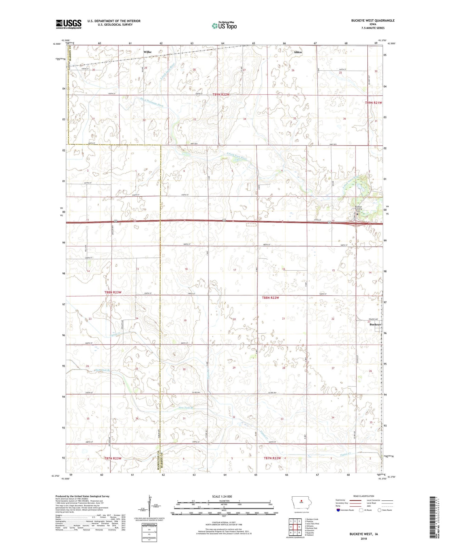
2022 topographic map quadrangle Buckeye West in the state of Iowa. Scale: 1:24000. Based on the newly updated USGS 7.5' US Topo map series, this map is in the following counties: Hardin, Hamilton. The map contains contour data, water features, and other items you are used to seeing on USGS maps, but also has updated roads and other features. This is the next generation of topographic maps. Printed on high-quality waterproof paper with UV fade-resistant inks.
Quads adjacent to this one:
West: Williams
Northwest: Sheldon Creek
North: Popejoy
Northeast: Iowa Falls West
East: Buckeye East
Southeast: Hubbard
South: Radcliffe
Southwest: Ellsworth
This map covers the same area as the classic USGS quad with code o42093d4.
Contains the following named places: Big 4 Drainage Ditch, Buckeye, Buckeye Cemetery, City of Buckeye, Flowing Well County Park, New York Branch, Township of Buckeye, Wilke, Wilke Post Office