MyTopo
McCallsburg Iowa US Topo Map
Couldn't load pickup availability
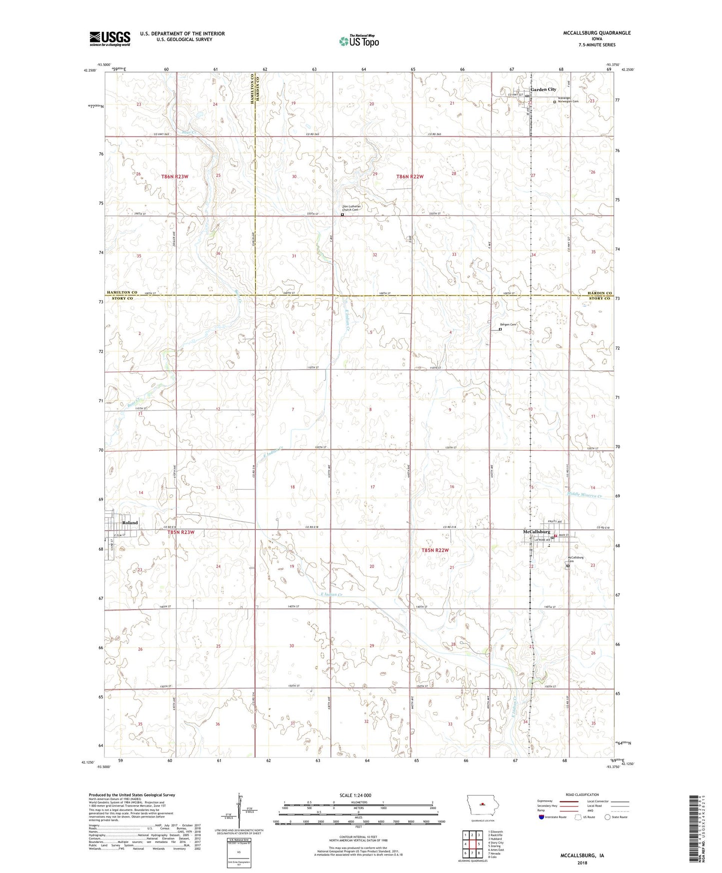
2022 topographic map quadrangle McCallsburg in the state of Iowa. Scale: 1:24000. Based on the newly updated USGS 7.5' US Topo map series, this map is in the following counties: Story, Hardin, Hamilton. The map contains contour data, water features, and other items you are used to seeing on USGS maps, but also has updated roads and other features. This is the next generation of topographic maps. Printed on high-quality waterproof paper with UV fade-resistant inks.
Quads adjacent to this one:
West: Story City
Northwest: Ellsworth
North: Radcliffe
Northeast: Hubbard
East: Zearing
Southeast: Colo
South: Nevada
Southwest: Ames East
This map covers the same area as the classic USGS quad with code o42093b4.
Contains the following named places: Bethany Lutheran Church, City of McCallsburg, Colo - Nesco North Learning Center, East Bergen Cemetery, Erickson Park, Garden City, Garden City Census Designated Place, Garden City Community Building, Garden City Fire Department, Garden City Post Office, McCallsburg, McCallsburg City Hall, Mccallsburg Emergency Services, McCallsburg Fire Department, McCallsburg Post Office, McCallsburg Presbyterian Church, Prarie Rail Trail, Roland, Roland - Story Middle School, Roland City Hall, Salem Lutheran Church, Stavanger Cemetery, Stavanger Lutheran Church, Township of Warren, Warren Township Cemetery, Zion Church, Zion Lutheran Church Cemetery, ZIP Codes: 50102, 50154, 50236