MyTopo
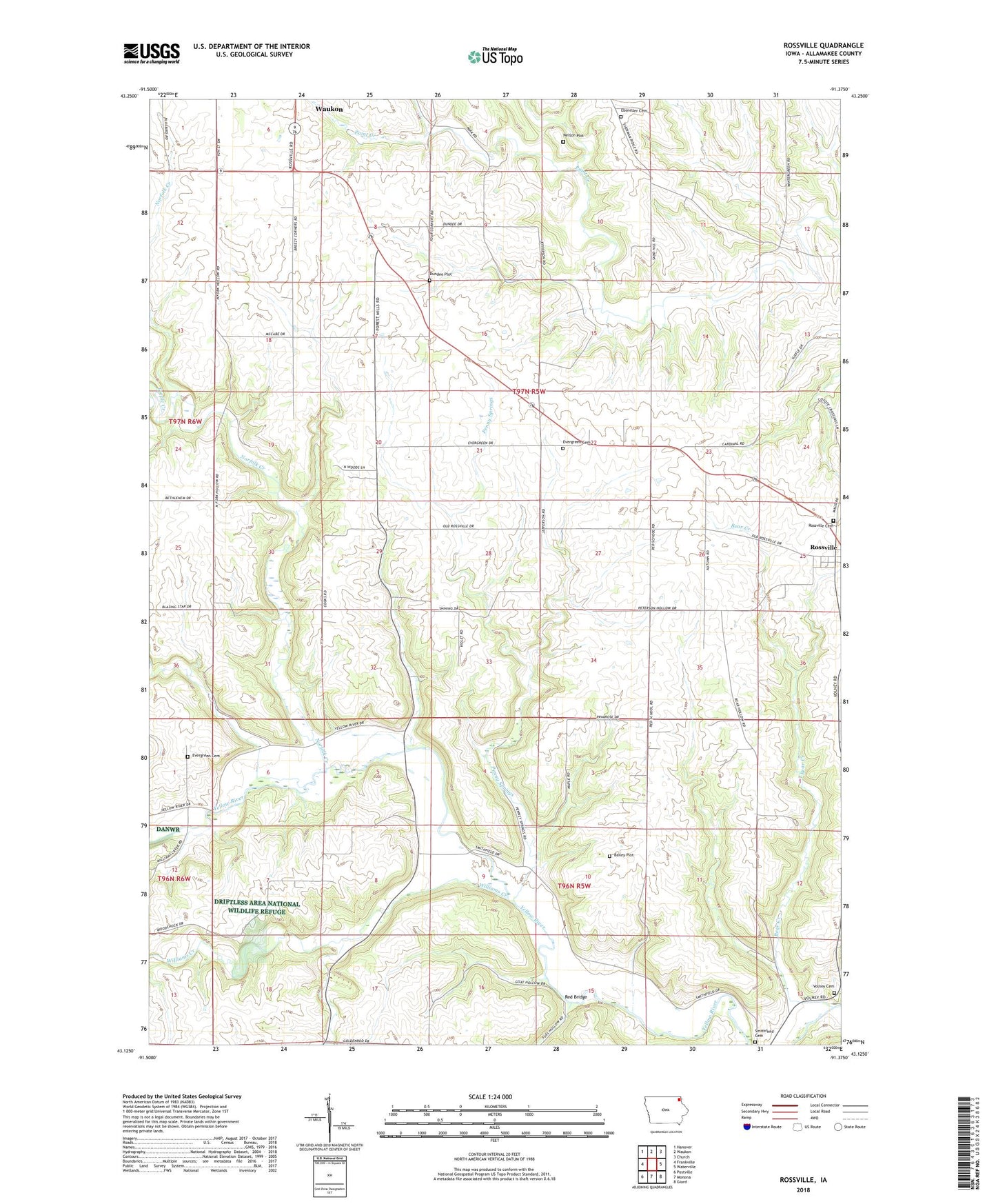
Rossville Iowa US Topo Map
Couldn't load pickup availability
2022 topographic map quadrangle Rossville in the state of Iowa. Scale: 1:24000. Based on the newly updated USGS 7.5' US Topo map series, this map is in the following counties: Allamakee. The map contains contour data, water features, and other items you are used to seeing on USGS maps, but also has updated roads and other features. This is the next generation of topographic maps. Printed on high-quality waterproof paper with UV fade-resistant inks.
Quads adjacent to this one:
West: Frankville
Northwest: Hanover
North: Waukon
Northeast: Church
East: Waterville
Southeast: Giard
South: Monona
Southwest: Postville
This map covers the same area as the classic USGS quad with code o43091b4.
Contains the following named places: Bailey Plot, Bear Creek, Cleveland Cemetery, Cleveland Post Office, Dundee Plot, Ebenezer Cemetery, Evergreen Cemetery, Fandon Post Office, Forest Mills Post Office, Manchester, Nelson Plot, Norfolk Creek, Penny Springs, Red Bridge, Rossville, Rossville Cemetery, Rossville Post Office, Smithfield Cemetery, Teeple Creek, Township of Jefferson, Volney Cemetery, Williams Creek