MyTopo
Monona Iowa US Topo Map
Couldn't load pickup availability
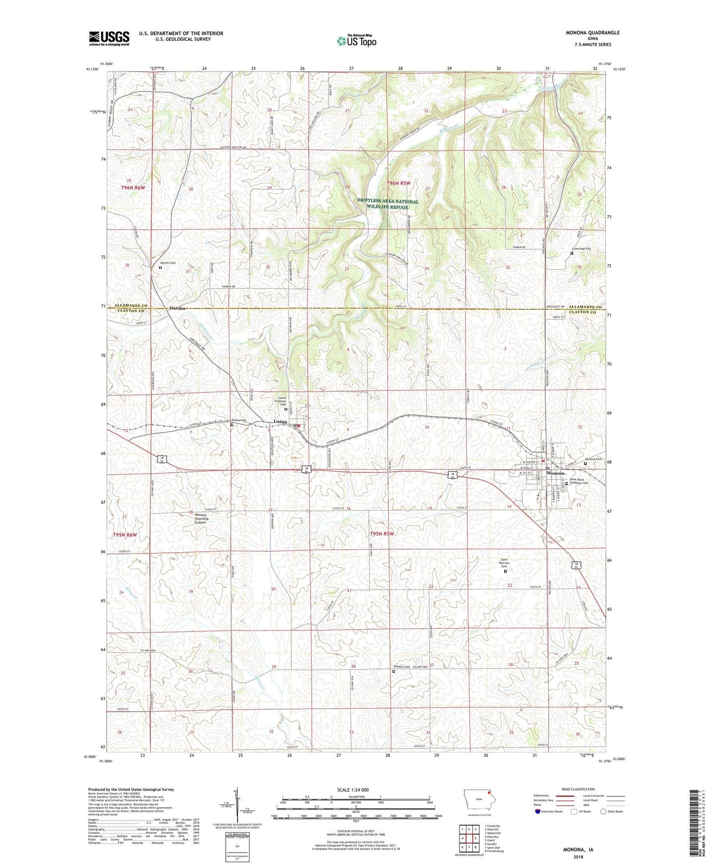
2022 topographic map quadrangle Monona in the state of Iowa. Scale: 1:24000. Based on the newly updated USGS 7.5' US Topo map series, this map is in the following counties: Clayton, Allamakee. The map contains contour data, water features, and other items you are used to seeing on USGS maps, but also has updated roads and other features. This is the next generation of topographic maps. Printed on high-quality waterproof paper with UV fade-resistant inks.
Quads adjacent to this one:
West: Postville
Northwest: Frankville
North: Rossville
Northeast: Waterville
East: Giard
Southeast: Farmersburg
South: Saint Olaf
Southwest: Gunder
This map covers the same area as the classic USGS quad with code o43091a4.
Contains the following named places: City of Luana, City of Monona, City of Monona Wastewater Treatment Plant, Cummings Plot, Elkader Medical Associates Office, Family Dentistry Associates Center, Garden City United Methodist Church, Gateway Park, Gateway Park Campground, Hardin, Hardin Cemetery, Hickory Creek, Luana, Luana Cemetery, Luana City Hall, Luana Elementary School, Luana Lutheran Cemetery, Luana Lutheran Church, Luana Post Office, Luana Softball Diamond, Luana Volunteer Fire Department, MFL Ambulance Service, MFL MarMac Elementary School, MFL MarMac High School, Monona, Monona Cemetery, Monona City Park, Monona Clinic, Monona Dental Services Center, Monona Fire Department, Monona Historical Museum, Monona Police Department, Monona Post Office, Monona Township Culbert, Murphy Memorial Library, Pioneer Cemetery, Saint Patricks Cemetery, Saint Patricks Church, Saint Paul Lutheran Church, Township of Franklin, Township of Monona, Tri-Club Golf Club, ZIP Code: 52156