MyTopo
Giard Iowa US Topo Map
Couldn't load pickup availability
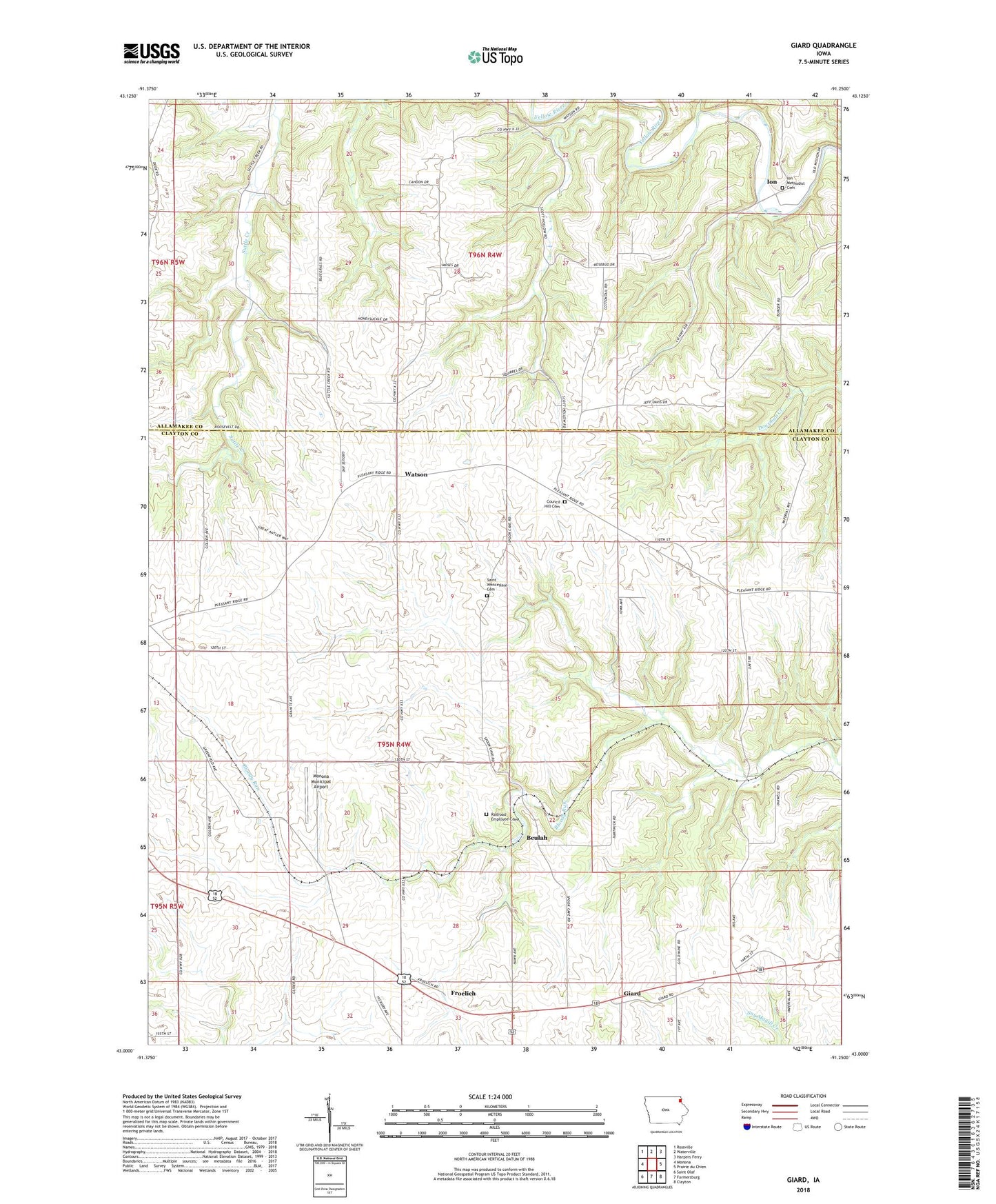
2022 topographic map quadrangle Giard in the state of Iowa. Scale: 1:24000. Based on the newly updated USGS 7.5' US Topo map series, this map is in the following counties: Clayton, Allamakee. The map contains contour data, water features, and other items you are used to seeing on USGS maps, but also has updated roads and other features. This is the next generation of topographic maps. Printed on high-quality waterproof paper with UV fade-resistant inks.
Quads adjacent to this one:
West: Monona
Northwest: Rossville
North: Waterville
Northeast: Harpers Ferry
East: Prairie du Chien
Southeast: Clayton
South: Farmersburg
Southwest: Saint Olaf
This map covers the same area as the classic USGS quad with code o43091a3.
Contains the following named places: Beulah, Beulah Post Office, Council Hill Cemetery, Council Hill Post Office, Froelich, Froelich Historic Site, Froelich Post Office, Giard, Giard Post Office, Giard Station, Giard Townhall, Giard United Methodist Church, Ion, Ion Methodist Cemetery, Ion Post Office, Monona Municipal Airport, Old Stone Church, Railroad Employee Cemetery, Saint Wenceslaus Cemetery, Spook Cave and Campground, Township of Giard, Valdora, Watson, ZIP Code: 52159