MyTopo
Webster City Iowa US Topo Map
Couldn't load pickup availability
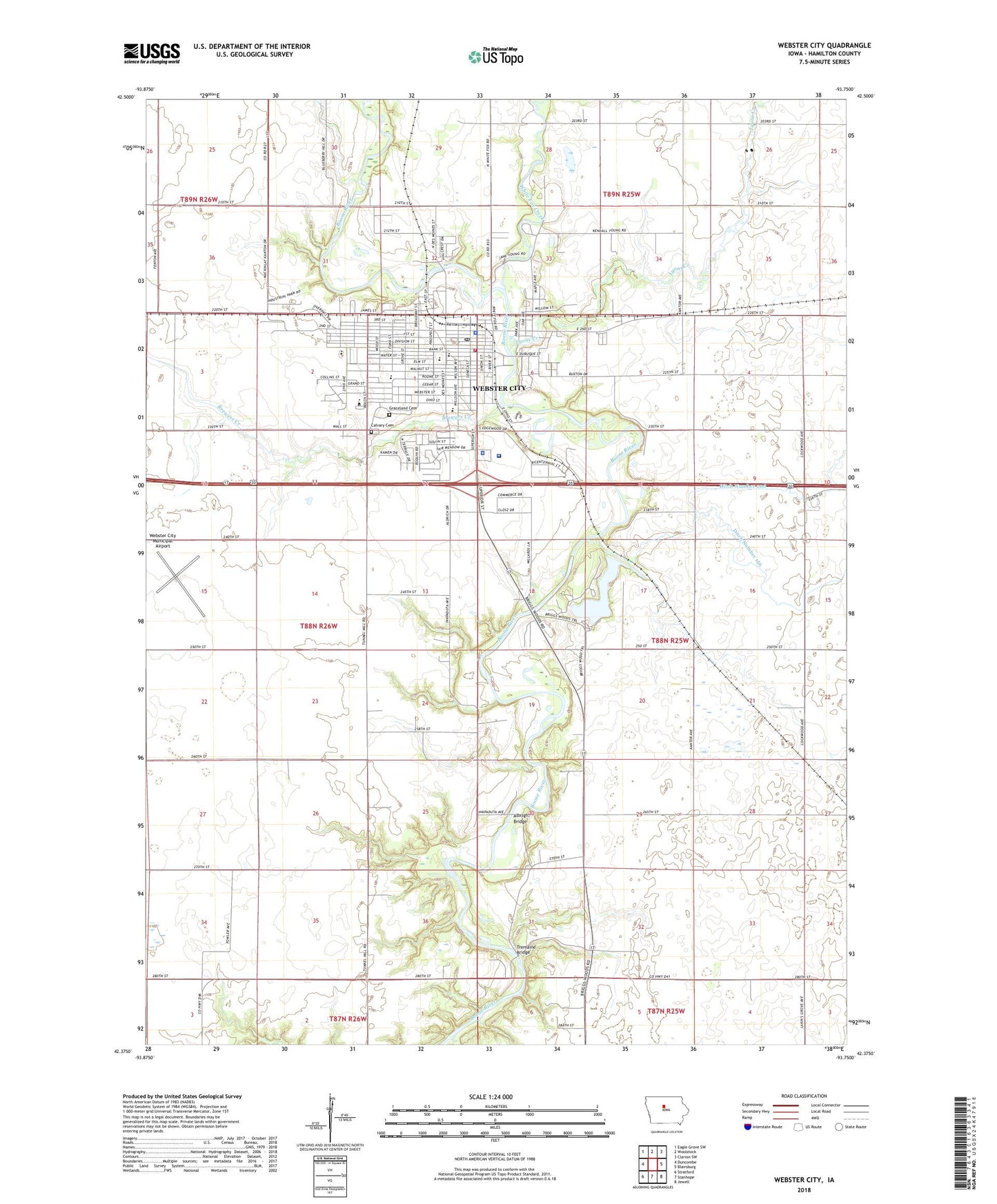
2022 topographic map quadrangle Webster City in the state of Iowa. Scale: 1:24000. Based on the newly updated USGS 7.5' US Topo map series, this map is in the following counties: Hamilton. The map contains contour data, water features, and other items you are used to seeing on USGS maps, but also has updated roads and other features. This is the next generation of topographic maps. Printed on high-quality waterproof paper with UV fade-resistant inks.
Quads adjacent to this one:
West: Duncombe
Northwest: Eagle Grove SW
North: Woolstock
Northeast: Clarion SW
East: Blairsburg
Southeast: Jewell
South: Stanhope
Southwest: Stratford
This map covers the same area as the classic USGS quad with code o42093d7.
Contains the following named places: Albright Bridge, Asbury Methodist Nursery School, Asbury United Methodist Church, Barner Wildlife Area Number One, Bauer Slough, Bonebright Museum Complex, Brewers Creek, Briggs Woods County Park, Briggs Woods Golf Course Club, Buck Creek, Calvary Baptist Church, Calvary Cemetery, Church of Christ, City of Webster City, Ditch Number 166, Dragoon Trail in Hamilton County Historical Marker, Drummer Boy at Shiloh Historical Marker, Elm Park School, Episcopal Church, Faith Community Church, Faith United Methodist Church, Family Practice Clinic, First Assembly of God Church, First Baptist Church, First Christian Science Church, First Congregational United Church, First White Settler in Webster City Historical Marker, Graceland Cemetery, Hamilton County Sheriff's Office, Hamilton County Speedway, Hamilton Regional High School, Harmony Center School, Hcph Heliport, Hillcrest Mobile Home Park, Hilltop School, Iowa Central Community College - Webster City Campus, Kendall Young Park, Kendall Young Public Library, Kingdom Hall of Jehovah's Witnesses, KQWC-AM (Webster City), KQWC-FM (Webster City), Lawn Hill School, Lyons Creek, McFarland Clinic, Mid-Iowa Surgery Center, New Hope Church, Nokomi's Park, Performance Emergency Ambulance Services, Pleasant View Elementary School, Poplar Grove Post Office, Reorganized Church of Jesus Christ of Latter Day Saints, Riverside City Park, Riverview Recreation Field, Riverview School, Saint Paul's Lutheran Church, Saint Thomas Aquinas Catholic Church, Saint Thomas Aquinas School, South School, Sunset Heights Elementary School, Township of Independence, Tremaine Bridge, Trinity Evangelical Lutheran Church, United Co-operative Elevator, Van Diest Medical Center, Webster City, Webster City Center Library, Webster City City Hall, Webster City Country Club, Webster City Fire Department, Webster City High School, Webster City Medical Clinic, Webster City Middle School, Webster City Municipal Airport, Webster City Police Department, Webster City Post Office, White Fox Creek, Wilson Brewer Memorial Park, Wolfe Clinic Eye Center, ZIP Code: 50595