MyTopo
Hartley SW Iowa US Topo Map
Couldn't load pickup availability
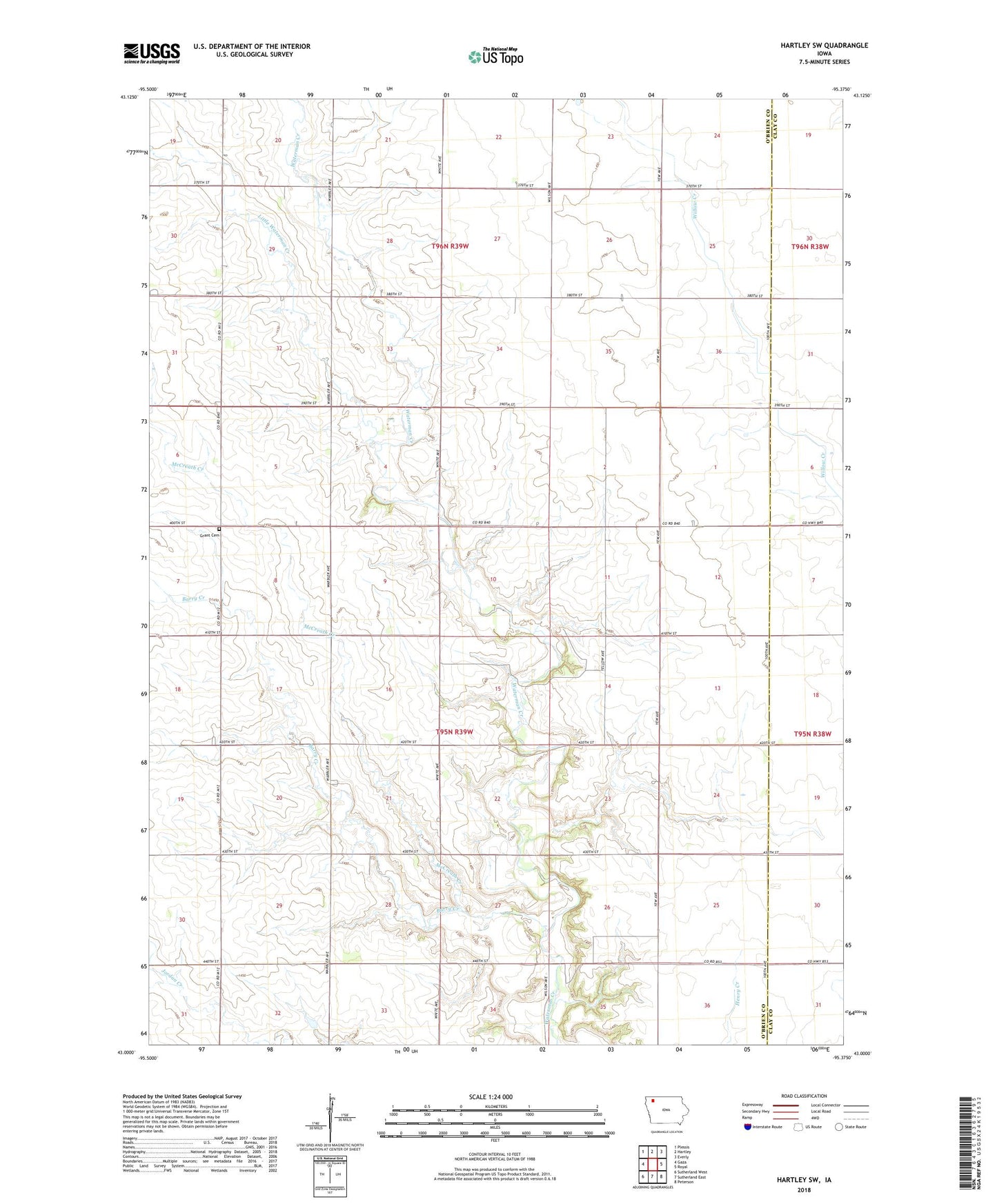
2022 topographic map quadrangle Hartley SW in the state of Iowa. Scale: 1:24000. Based on the newly updated USGS 7.5' US Topo map series, this map is in the following counties: O'Brien, Clay. The map contains contour data, water features, and other items you are used to seeing on USGS maps, but also has updated roads and other features. This is the next generation of topographic maps. Printed on high-quality waterproof paper with UV fade-resistant inks.
Quads adjacent to this one:
West: Gaza
Northwest: Plessis
North: Hartley
Northeast: Everly
East: Royal
Southeast: Peterson
South: Sutherland East
Southwest: Sutherland West
This map covers the same area as the classic USGS quad with code o43095a4.
Contains the following named places: Barry Creek, City View Farms, Covey Church, Covey Church Cemetery, Covey Church Park, Grant Bible Church, Grant Townhall, Litka Park, McCreath Creek, Rahbusch Tract, Township of Grant, Waterman Wildlife Area, Weale Area