MyTopo
Royal Iowa US Topo Map
Couldn't load pickup availability
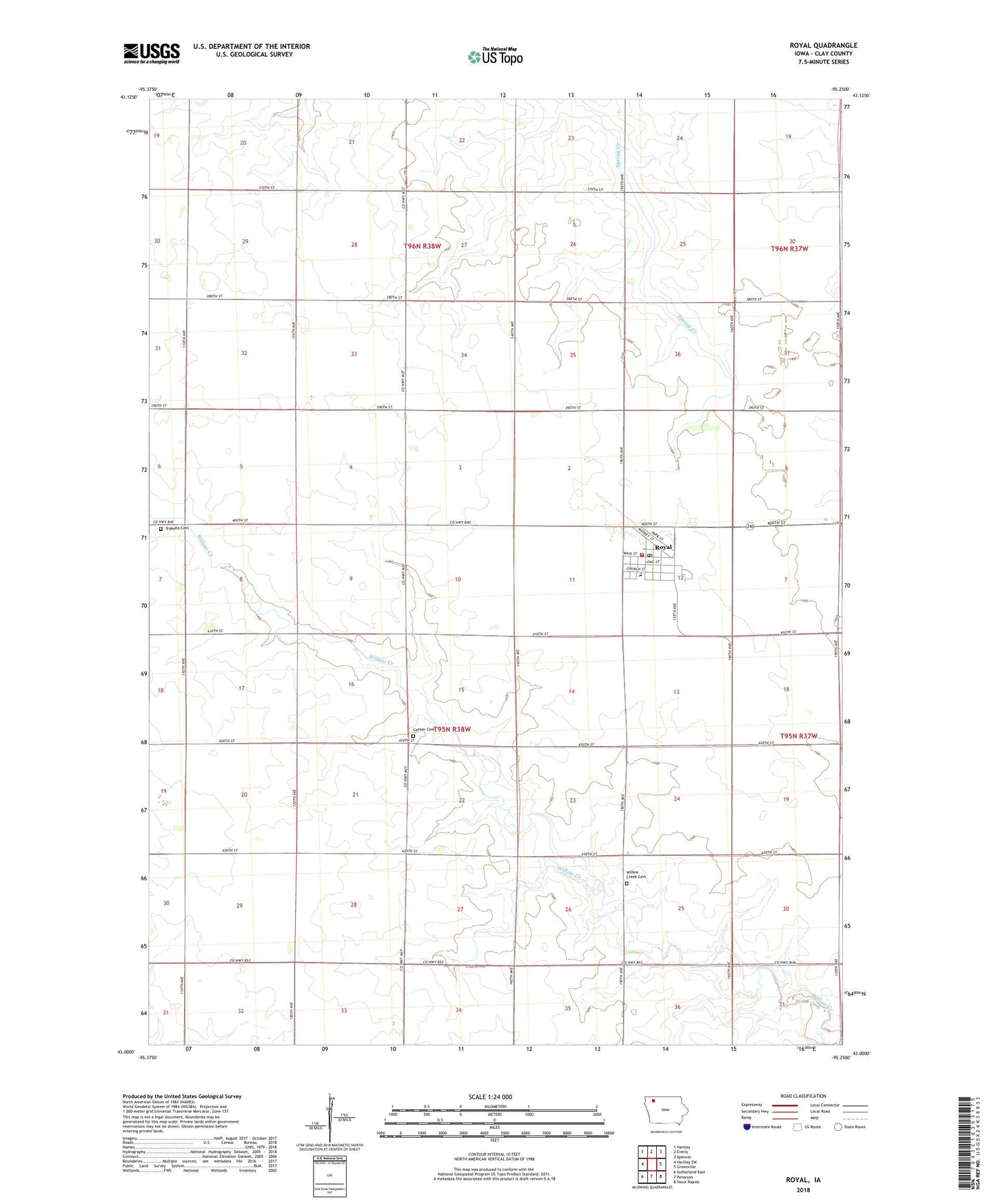
2022 topographic map quadrangle Royal in the state of Iowa. Scale: 1:24000. Based on the newly updated USGS 7.5' US Topo map series, this map is in the following counties: Clay. The map contains contour data, water features, and other items you are used to seeing on USGS maps, but also has updated roads and other features. This is the next generation of topographic maps. Printed on high-quality waterproof paper with UV fade-resistant inks.
Quads adjacent to this one:
West: Hartley SW
Northwest: Hartley
North: Everly
Northeast: Spencer
East: Greenville
Southeast: Sioux Rapids
South: Peterson
Southwest: Sutherland East
This map covers the same area as the classic USGS quad with code o43095a3.
Contains the following named places: Bethlehem Lutheran Church, City of Royal, Clay Center Cemetery, Clay Central - Everly Junior / Senior High School at Royal, Clay Central Everly Elementary School, Fahnlander Farms, Gross Farms, Ingleville, Ingleville Post Office, Kunzman Farm, Le Clair Farm, Maple Grove Church, Meadowbrook Farm, Royal, Royal Airport, Royal City Hall, Royal Fire and Rescue, Royal Post Office, Royal Public Library, Saint Louis Catholic Church, Steinbeck Farms, Township of Clay, Tri Mello Cemetery, TriMello, Trimello Post Office, Trinity Lutheran Church, United Methodist Church, Wede Farms, Willow Creek Cemetery, Willow Creek Post Office, Woolston Hog Farm, Yankee Post Office, ZIP Code: 51357