MyTopo
Woden Iowa US Topo Map
Couldn't load pickup availability
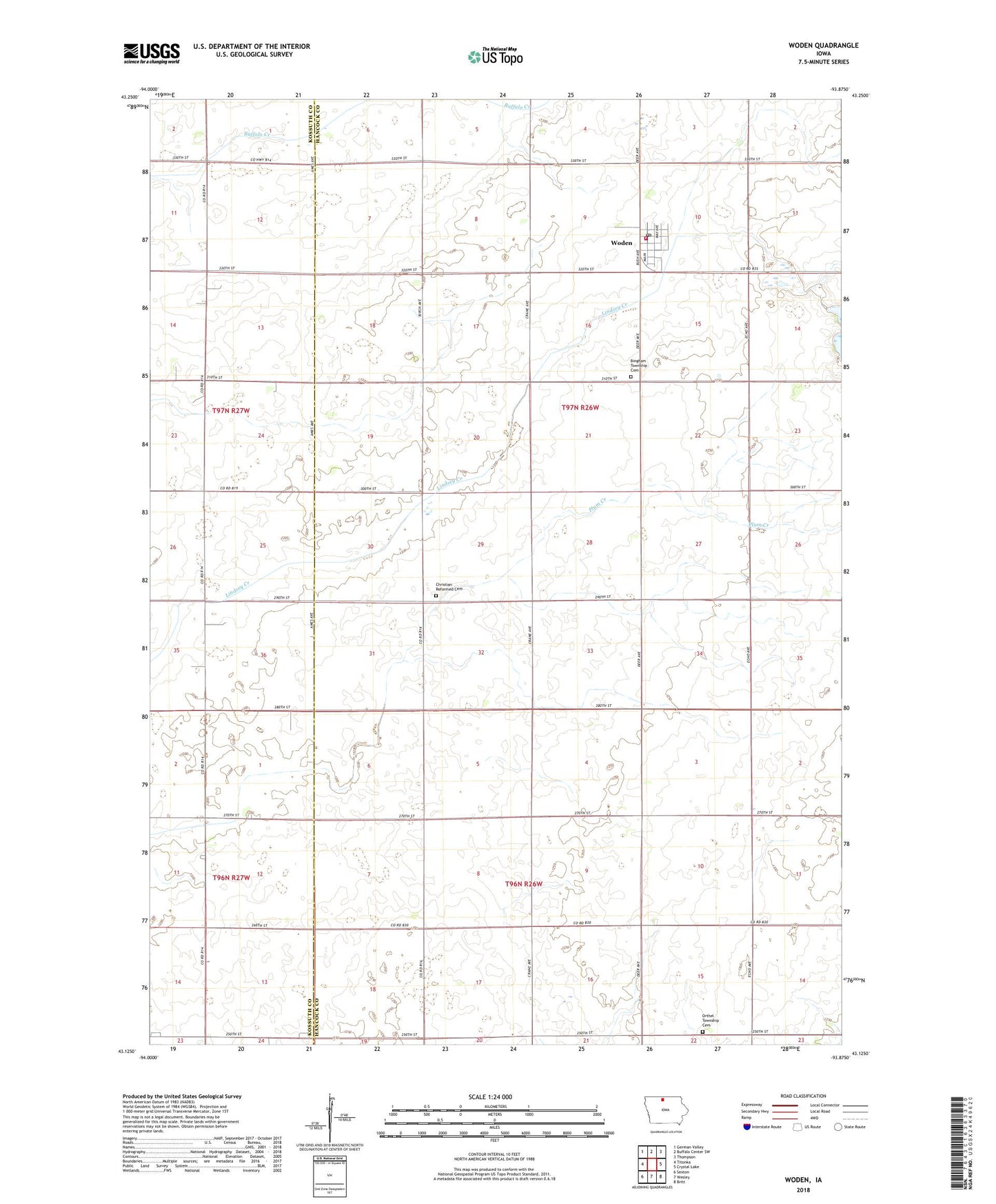
2022 topographic map quadrangle Woden in the state of Iowa. Scale: 1:24000. Based on the newly updated USGS 7.5' US Topo map series, this map is in the following counties: Hancock, Kossuth. The map contains contour data, water features, and other items you are used to seeing on USGS maps, but also has updated roads and other features. This is the next generation of topographic maps. Printed on high-quality waterproof paper with UV fade-resistant inks.
Quads adjacent to this one:
West: Titonka
Northwest: German Valley
North: Buffalo Center SW
Northeast: Thompson
East: Crystal Lake
Southeast: Britt
South: Wesley
Southwest: Sexton
This map covers the same area as the classic USGS quad with code o43093b8.
Contains the following named places: Bingham Township Cemetery, Buffalo Creek, Christian Reformed Cemetery, City of Woden, Drainage Ditch Number 97, Farmers Co-op Elevator, First Presbyterian Church, Lindsey Creek, Orthel Township Cemetery, Plum Creek, Sacred Heart Catholic Church, Saint Johns Lutheran Church, Township of Bingham, Township of Orthel, Woden, Woden Church, Woden Community Center, Woden Fire Department, Woden Post Office, Woden Public Library, ZIP Code: 50484