MyTopo
Titonka Iowa US Topo Map
Couldn't load pickup availability
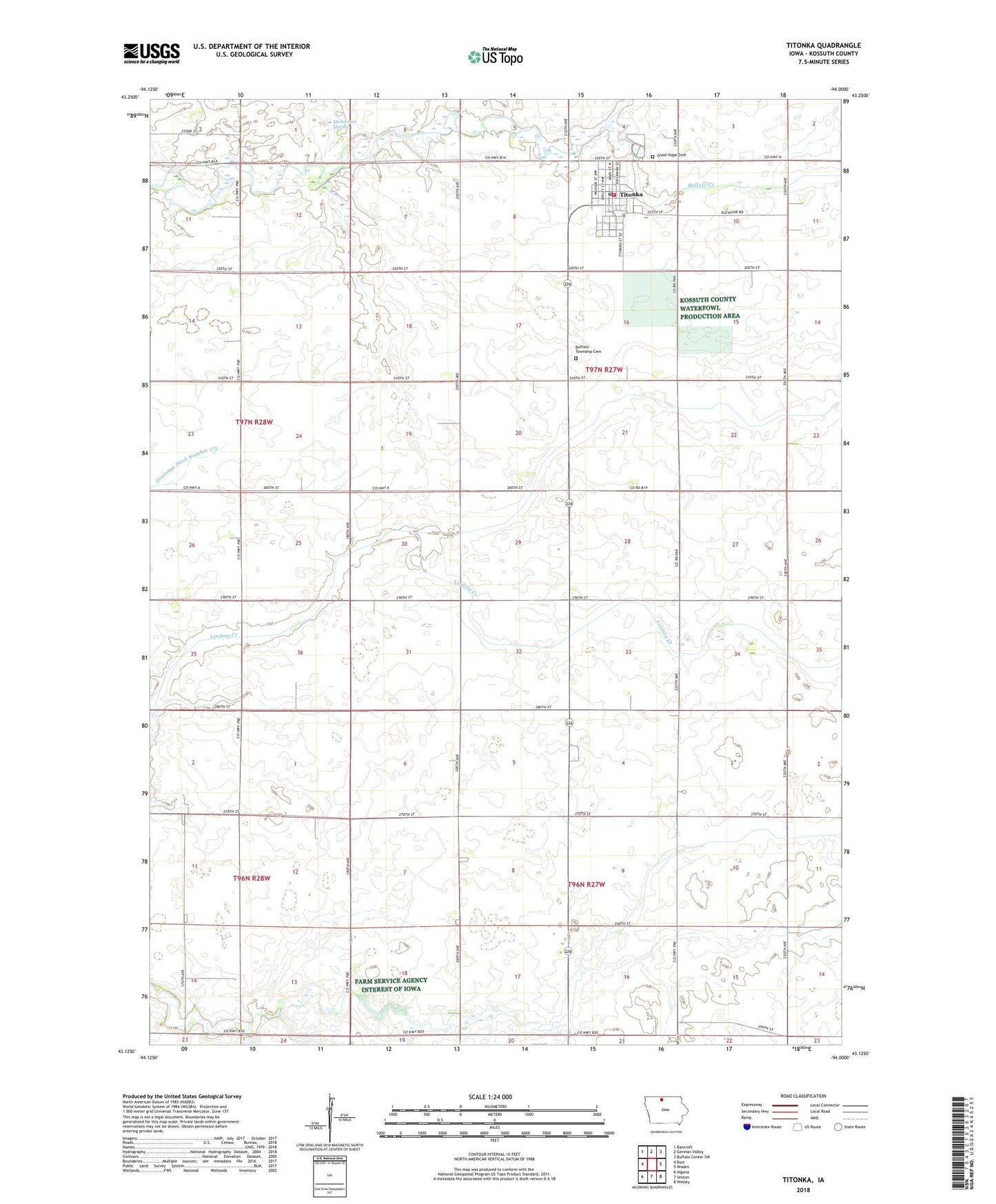
2022 topographic map quadrangle Titonka in the state of Iowa. Scale: 1:24000. Based on the newly updated USGS 7.5' US Topo map series, this map is in the following counties: Kossuth. The map contains contour data, water features, and other items you are used to seeing on USGS maps, but also has updated roads and other features. This is the next generation of topographic maps. Printed on high-quality waterproof paper with UV fade-resistant inks.
Quads adjacent to this one:
West: Burt
Northwest: Bancroft
North: German Valley
Northeast: Buffalo Center SW
East: Woden
Southeast: Wesley
South: Sexton
Southwest: Algona
This map covers the same area as the classic USGS quad with code o43094b1.
Contains the following named places: Buffalo Township Cemetery, City of Titonka, Doan Church, Good Hope Cemetery, Little Buffalo Creek, Michaelsen Marsh, Silo Home, Stateline Co-op Elevator, Titonka, Titonka Ambulance Service, Titonka Care Center, Titonka City Hall, Titonka Elementary School, Titonka Medical Center, Titonka Post Office, Titonka Public Library, Titonka Volunteer Fire Department, Township of Buffalo, Township of Wesley