MyTopo
Webb Iowa US Topo Map
Couldn't load pickup availability
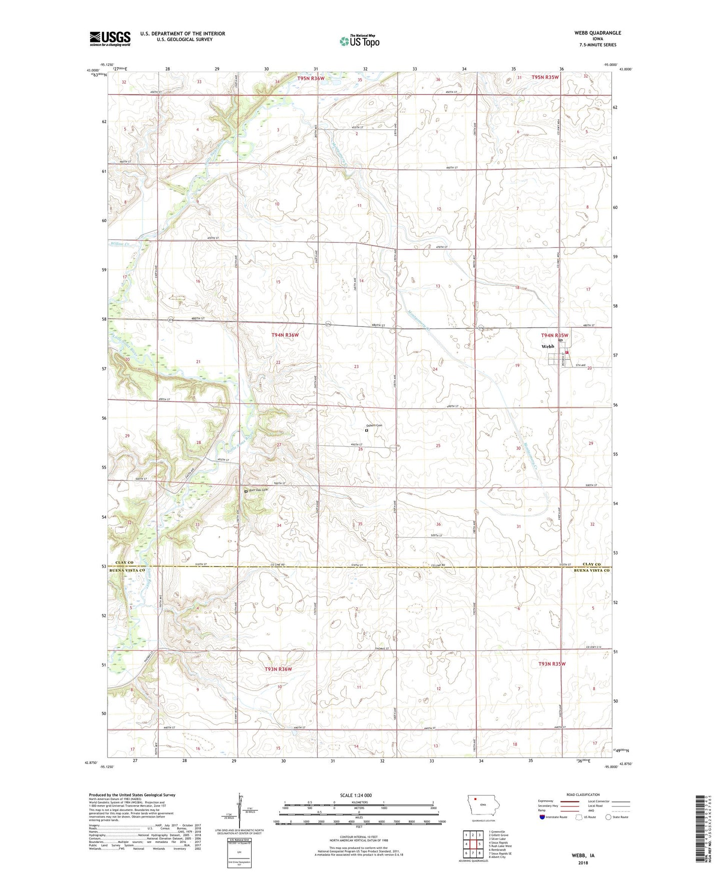
2022 topographic map quadrangle Webb in the state of Iowa. Scale: 1:24000. Based on the newly updated USGS 7.5' US Topo map series, this map is in the following counties: Clay, Buena Vista. The map contains contour data, water features, and other items you are used to seeing on USGS maps, but also has updated roads and other features. This is the next generation of topographic maps. Printed on high-quality waterproof paper with UV fade-resistant inks.
Quads adjacent to this one:
West: Sioux Rapids
Northwest: Greenville
North: Gillett Grove
Northeast: Silver Lake
East: Rush Lake West
Southeast: Albert City
South: Sioux Rapids SE
Southwest: Rembrandt
This map covers the same area as the classic USGS quad with code o42095h1.
Contains the following named places: Boge Farms, Burr Area, Burr Oak Cemetery, City of Webb, Elser Farms, First Baptist Church, Greene Acres, Herdland Post Office, Herrig Farms, High Bridge Wildlife Area, J and N Farms, Kenobbie Farms, Kentwood Farms, Kindlespire County Park, Maclay, Montgomery Creek, Osborn Cemetery, Simons Farm, Sylvester's Farms, Township of Herdland, Webb, Webb Fire and Rescue, Webb Post Office, Willow Creek, ZIP Code: 51366