MyTopo
Woolstock Iowa US Topo Map
Couldn't load pickup availability
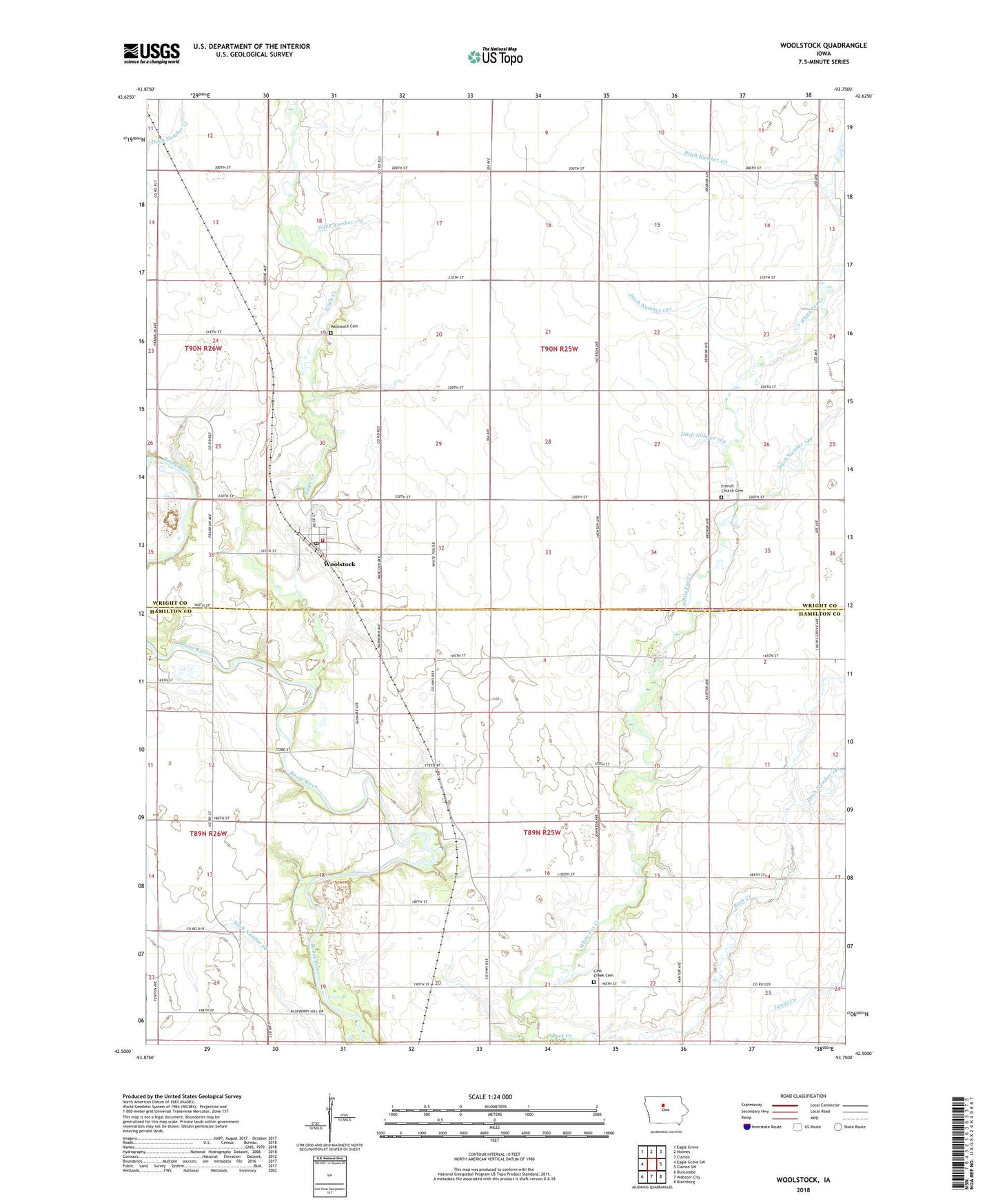
2022 topographic map quadrangle Woolstock in the state of Iowa. Scale: 1:24000. Based on the newly updated USGS 7.5' US Topo map series, this map is in the following counties: Wright, Hamilton. The map contains contour data, water features, and other items you are used to seeing on USGS maps, but also has updated roads and other features. This is the next generation of topographic maps. Printed on high-quality waterproof paper with UV fade-resistant inks.
Quads adjacent to this one:
West: Eagle Grove SW
Northwest: Eagle Grove
North: Holmes
Northeast: Clarion
East: Clarion SW
Southeast: Blairsburg
South: Webster City
Southwest: Duncombe
This map covers the same area as the classic USGS quad with code o42093e7.
Contains the following named places: Cass Center Cemetery, City of Woolstock, Ditch Number 124, Ditch Number 130, Ditch Number 149, Ditch Number 171, Ditch Number 172, Ditch Number 68, Eagle Creek, French Church, French Church Cemetery, Grandgeorge Quarry, Mark and Sadie Bishop Conservation Area, Saint Peters Lutheran Church, Saratoga Post Office, Township of Cass, Township of Woolstock, United Methodist Church, Wool Stock Post Office, Woolstock, Woolstock Cemetery, Woolstock City Hall, Woolstock Community Fire Department, Woolstock Community Hall, Woolstock Post Office, ZIP Code: 50599