MyTopo
Bolton Kansas US Topo Map
Couldn't load pickup availability
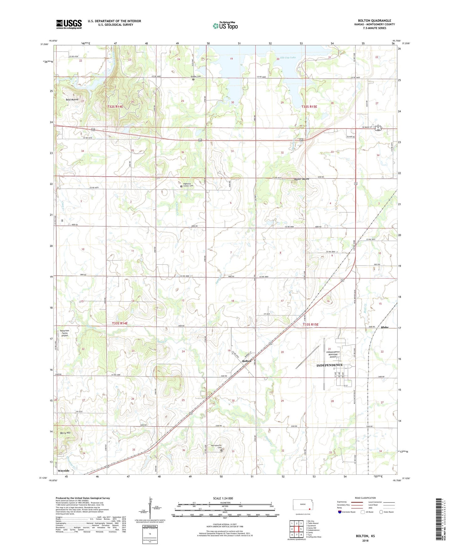
2023 topographic map quadrangle Bolton in the state of Kansas. Scale: 1:24000. Based on the newly updated USGS 7.5' US Topo map series, this map is in the following counties: Montgomery. The map contains contour data, water features, and other items you are used to seeing on USGS maps, but also has updated roads and other features. This is the next generation of topographic maps. Printed on high-quality waterproof paper with UV fade-resistant inks.
Quads adjacent to this one:
West: Caney NW
Northwest: Elk City
North: Table Mound
Northeast: Sycamore
East: Independence
Southeast: Coffeyville West
South: Tyro
Southwest: Caney
This map covers the same area as the classic USGS quad with code o37095b7.
Contains the following named places: Bald Mound, Blake, Bolton, Chetopa Creek, Christian Church, Coon Creek, Fairview School, Four Corners School, Frontline Baptist Church, Grass, Harrisonville, Harrisonville Cemetery, Harrisonville School, Highland Center Cemetery, Highland Center School, Independence Army Air Field, Independence Municipal Airport, James School, Oak Ridge School, Patterson Farms Airport, Pleasant Prairie Church, Pleasant Valley School, Quaker Cemetery, Quaker Church, Squaw Creek Cove South Public Use Area, Township of Independence, Walker Mound, Wayside Census Designated Place, White Post School, ZIP Code: 67301