MyTopo
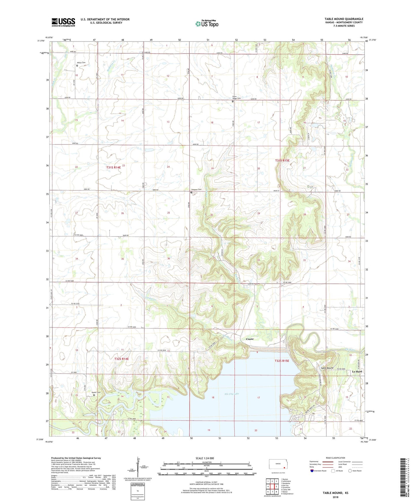
Table Mound Kansas US Topo Map
Couldn't load pickup availability
2023 topographic map quadrangle Table Mound in the state of Kansas. Scale: 1:24000. Based on the newly updated USGS 7.5' US Topo map series, this map is in the following counties: Montgomery. The map contains contour data, water features, and other items you are used to seeing on USGS maps, but also has updated roads and other features. This is the next generation of topographic maps. Printed on high-quality waterproof paper with UV fade-resistant inks.
Quads adjacent to this one:
West: Elk City
Northwest: Buxton
North: Lafontaine
Northeast: Neodesha
East: Sycamore
Southeast: Independence
South: Bolton
Southwest: Caney NW
This map covers the same area as the classic USGS quad with code o37095c7.
Contains the following named places: Card Creek, Card Creek Public Use Area, Central School, Crane, Elk City Dam, Elk City Lake, Elk City State Park, Elk City State Park Comfort Cove Camping Area, Elk City State Park Office, Elk City State Park Prairie Meadow Camping Area, Elk City State Park Sunset Point Camping Area, Elk City State Park Timber Road Camping Area, Elk City Wildlife Area, Elm Branch, Farm Ridge Cemetery, Farm Ridge School, Gamble School, Gordon Creek, Le Hunt, Mulberry Creek, Oak Ridge Public Use Area, Parker Cemetery, Prairie School, Racket Creek, Rich Valley School, Simpson Cemetery, Simpson Church, Squaw Creek, Squaw Creek Cove North Public Use Area, Sternerton, Sycamore Valley Church, Table Mound, Township of Sycamore, White Cemetery