MyTopo
Independence Kansas US Topo Map
Couldn't load pickup availability
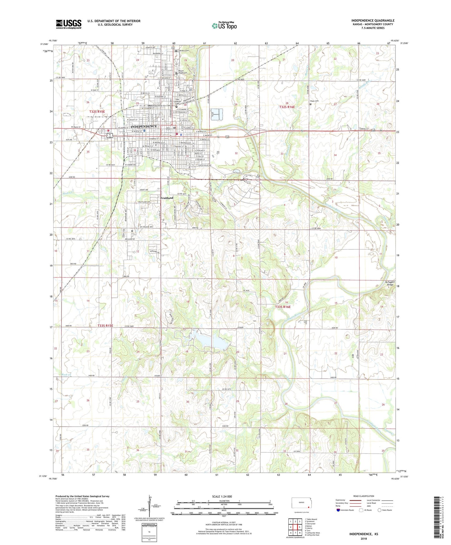
2022 topographic map quadrangle Independence in the state of Kansas. Scale: 1:24000. Based on the newly updated USGS 7.5' US Topo map series, this map is in the following counties: Montgomery. The map contains contour data, water features, and other items you are used to seeing on USGS maps, but also has updated roads and other features. This is the next generation of topographic maps. Printed on high-quality waterproof paper with UV fade-resistant inks.
Quads adjacent to this one:
West: Bolton
Northwest: Table Mound
North: Sycamore
Northeast: Cherryvale
East: Liberty
Southeast: Coffeyville East
South: Coffeyville West
Southwest: Tyro
This map covers the same area as the classic USGS quad with code o37095b6.
Contains the following named places: Beachner Grain Elevator Number 9, Berean Christian Mission, Bible Holiness Church, Bloody Run, Brookside Mobile Home Estates, Calvary Cemetery, Central School, Church of Christ, Church of God, Church of God in Christ, Church of the Epiphany, City of Independence, Clear Creek, Coal Creek, Coal Creek School, Community Christian Church, Congregational United Church of Christ, Crystalbrook Church, Drum Creek, Eisenhower Elementary School, Evangelical Friends Church, First Assembly of God Church, First Baptist Church - North Campus, First Baptist Church - South Campus, First Church of the Nazarene, First Presbyterian Church, First Southern Baptist Church, First United Methodist Church, Forty School, Fruitland, Glen Ash Youth Center, Grace Memorial United Methodist Church, Independence, Independence Bible Elementary School, Independence Bible School, Independence Chamber of Commerce, Independence Church of the Brethern, Independence City Hall, Independence City Public Works, Independence Community College, Independence Community College Academic Building, Independence Community College Administration Building, Independence Community College Cessna Learning Center, Independence Community College Fine Arts Building, Independence Community College Inge Theater, Independence Community College Observatory, Independence Community College Student Union, Independence Emergency Medical Services, Independence Fire Department, Independence First Christian Church, Independence High School, Independence Historical Museum, Independence Middle School, Independence Police Department, Independence Post Office, Independence Public Library, Independence Science and Technology Center, Independence Seventh Day Adventist Church, Independence Wastewater Plant, Independence Wesleyan Church, KIND-AM (Independence), KIND-FM (Independence), Kingdom Hall of Jehovah's Witnesses, Lighthouse Baptist Church, Lincoln Elementary School, Maple Grove School, Maple Street Baptist Church, McTaggart Bridge, Memorial Hall, Mercy Hospital - Independence, Montgomery County, Montgomery County Courthouse, Montgomery County District Court Independence, Montgomery County Health Department, Montgomery County Jail, Montgomery County Public Works, Montgomery County Rural Fire District Station 1, Montgomery County Sheriff's Office, Montgomery County State Lake, Montgomery County State Lake Dam, Montgomery County State Park, Morgantown School, Mount Hope Cemetery, Mouse Creek, Moyer Dam, Overfield School, Pentecostal Holiness Church, Pratt Cemetery, Quinn Chapel African Methodist Episcopal Church, Ralph Mitchell Zoo, Riley Elementary School, Riverside Beach Family Aquatic Center, Riverside Park, Riverside Southern Baptist Church, Rock Creek, Saint Andrew Catholic Church, Saint Andrew Catholic Elementary School, Saint John's Baptist Church, The Church of Jesus Christ of Latter Day Saints, United Brethren Church, United Pentecostal Church, Washington Elementary School, West Laurel Industrial Park, Youngs Chapel, Zion Lutheran Cemetery, Zion Lutheran Church, Zion Lutheran School