MyTopo
Sycamore Kansas US Topo Map
Couldn't load pickup availability
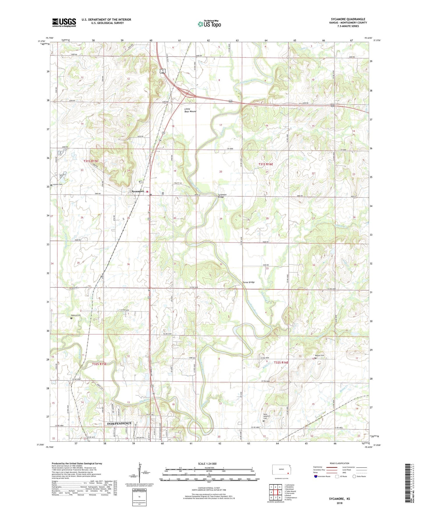
2022 topographic map quadrangle Sycamore in the state of Kansas. Scale: 1:24000. Based on the newly updated USGS 7.5' US Topo map series, this map is in the following counties: Montgomery. The map contains contour data, water features, and other items you are used to seeing on USGS maps, but also has updated roads and other features. This is the next generation of topographic maps. Printed on high-quality waterproof paper with UV fade-resistant inks.
Quads adjacent to this one:
West: Table Mound
Northwest: Lafontaine
North: Neodesha
Northeast: Morehead
East: Cherryvale
Southeast: Liberty
South: Independence
Southwest: Bolton
This map covers the same area as the classic USGS quad with code o37095c6.
Contains the following named places: Baker School, Bethel Cemetery, Brethren Church, Cherryvale Junior High School, Choteau Chapel, Choteau Creek, Elk River, Fairview School, Gravel Hill School, Independence Country Club, Irish Creek, Irish Creek School, KGGF - FM (Neodesha), Krone Cemetery, Larimer School, Little Bear Mound, Montgomery County Rural Fire District Station 6, Peebler School, Prior Creek, Radical Cemetery, Radical School, Rebel Creek, Saint Andrew's Cemetery, Salt Creek, Sycamore, Sycamore Bridge, Sycamore Census Designated Place, Sycamore Creek, Sycamore Post Office, Sycamore Valley Golf Course, Township of West Cherry, Turner Bridge, ZIP Code: 67363