MyTopo
Cato Kansas US Topo Map
Couldn't load pickup availability
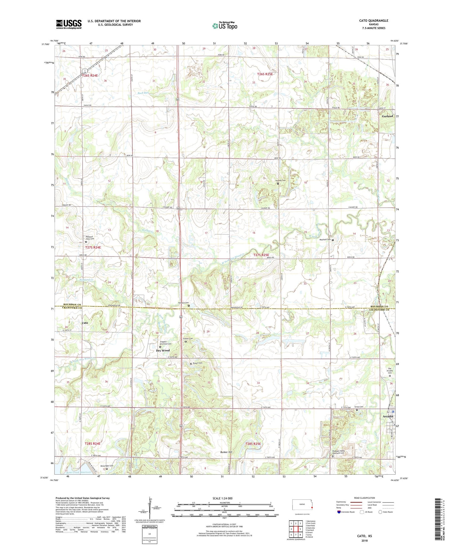
2022 topographic map quadrangle Cato in the state of Kansas. Scale: 1:24000. Based on the newly updated USGS 7.5' US Topo map series, this map is in the following counties: Bourbon, Crawford. The map contains contour data, water features, and other items you are used to seeing on USGS maps, but also has updated roads and other features. This is the next generation of topographic maps. Printed on high-quality waterproof paper with UV fade-resistant inks.
Quads adjacent to this one:
West: Hiattville
Northwest: Marmaton
North: Fort Scott
Northeast: Deerfield
East: Garland
Southeast: Liberal
South: Arma
Southwest: Girard
This map covers the same area as the classic USGS quad with code o37094f6.
Contains the following named places: Arcadia City Hall, Arcadia Police Department, Bible Tabernacle, Bone Creek, Brown Cemetery, Buck Run School, Bunker Hill School, Cato, Cherry Grove Baptist Church, Custer School, Dry Wood, Fowler Cemetery, Gish School, Gross Cemetery, Howard Cemetery, Humphrey School, Lane School, Large School, Lone Star School, Mayfield Cemetery, McGonigle Cemetery, Mount Zion Missionary Baptist Church, Old Arcadia Cemetery, Old Arcadia School, Pleasant Valley Sheffield Cemetery, Pleasant View Cemetery, Richland Creek, Standard School, Star School, Township of Drywood, Trogdon Drywood Cemetery, Tweedy Cemetery, Walnut Creek, ZIP Codes: 66711, 66741