MyTopo
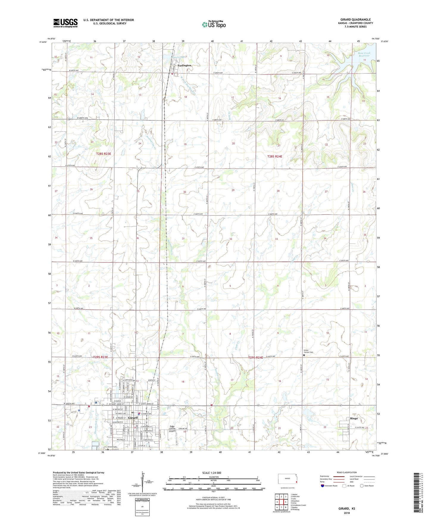
Girard Kansas US Topo Map
Couldn't load pickup availability
2022 topographic map quadrangle Girard in the state of Kansas. Scale: 1:24000. Based on the newly updated USGS 7.5' US Topo map series, this map is in the following counties: Crawford. The map contains contour data, water features, and other items you are used to seeing on USGS maps, but also has updated roads and other features. This is the next generation of topographic maps. Printed on high-quality waterproof paper with UV fade-resistant inks.
Quads adjacent to this one:
West: Brazilton
Northwest: Hepler
North: Hiattville
Northeast: Cato
East: Arma
Southeast: Pittsburg
South: Radley
Southwest: Grindstone Creek
This map covers the same area as the classic USGS quad with code o37094e7.
Contains the following named places: Bethany School, Calvary Bible Church, City of Girard, Clear Creek, Crawford County, Crawford County Courthouse, Crawford County Fairgrounds, Crawford County Fire District 4, Crawford County Jail, Crawford County Rural Fire District 4 Station 2, Crawford County Sheriff's Office, Farlington, Farlington Census Designated Place, Farlington United Methodist Church, First Baptist Church, First Christian Church, First Presbyterian Church, Frisco Lake, Garfield School, Girard, Girard Bible Church, Girard Cemetery, Girard City Hall, Girard Civic Center, Girard Fire Department, Girard High School, Girard Juvenile Detention Center, Girard Medical Center, Girard Medical Center Heliport, Girard Middle School, Girard Municipal Golf Course, Girard Municipal Power Plant, Girard Police Department, Girard Post Office, Girard Public Library, Girard United Methodist Church, Girard Wastewater Treatment Facility, Gunn School, Hadley, Harvest Time Holiness Church, Living Faith Church of the Nazarene, Lone Elm School, Museum of Crawford County, Ozark School, Prairie Bell School, Prairie View School, Producers Co - Operative Association Grain Elevator Number 2, R V Haderlein Elementary School, Ringo, Ringo Census Designated Place, Saint Michael's Catholic Church, Second Valley School, Sherman Township Fire Department, Township of Crawford, Township of Sherman, Trinity Lutheran Church, Union Center Cemetery, Winston Park, Ziggy Carline Airport, ZIP Code: 66734