MyTopo
Liberty Kansas US Topo Map
Couldn't load pickup availability
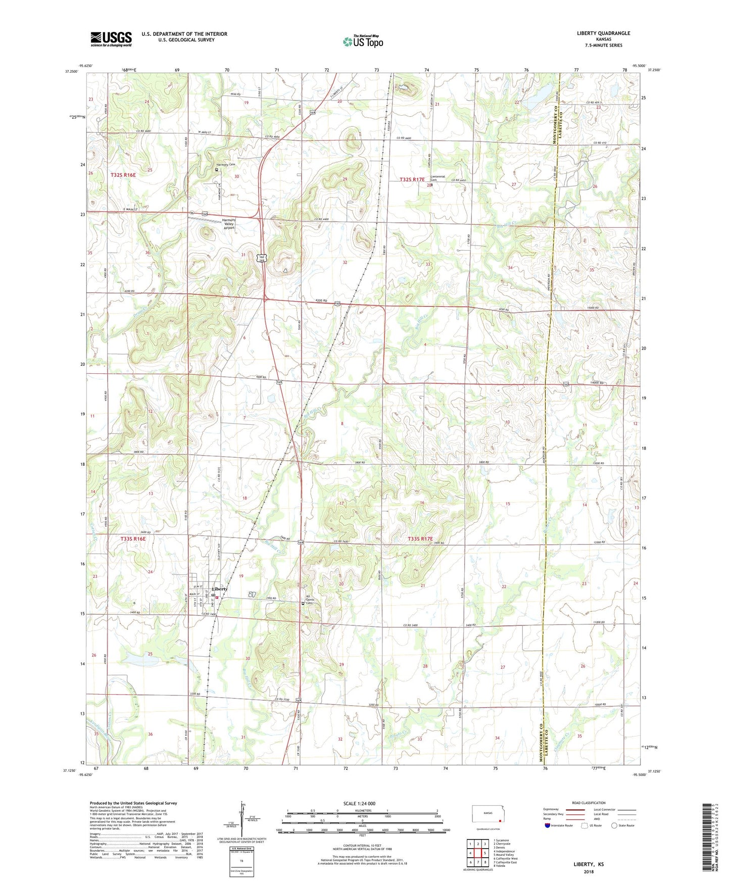
2022 topographic map quadrangle Liberty in the state of Kansas. Scale: 1:24000. Based on the newly updated USGS 7.5' US Topo map series, this map is in the following counties: Montgomery, Labette. The map contains contour data, water features, and other items you are used to seeing on USGS maps, but also has updated roads and other features. This is the next generation of topographic maps. Printed on high-quality waterproof paper with UV fade-resistant inks.
Quads adjacent to this one:
West: Independence
Northwest: Sycamore
North: Cherryvale
Northeast: Dennis
East: Mound Valley
Southeast: Valeda
South: Coffeyville East
Southwest: Coffeyville West
This map covers the same area as the classic USGS quad with code o37095b5.
Contains the following named places: All Saints Cemetery, Billings School, Breckenridge School, Centennial Cemetery, City of Liberty, Clymore Elementary School, Harmon School, Harmony Cemetery, Harmony Valley Airport, Lakeview Country Club, Liberty, Liberty Lakes, Liberty Post Office, Liberty Wastewater Plant, Montgomery County Rural Fire District Station 5, Nashville, Sunnyside School, Township of Drum Creek, Township of Liberty, ZIP Code: 67351