MyTopo
Cunningham Kansas US Topo Map
Couldn't load pickup availability
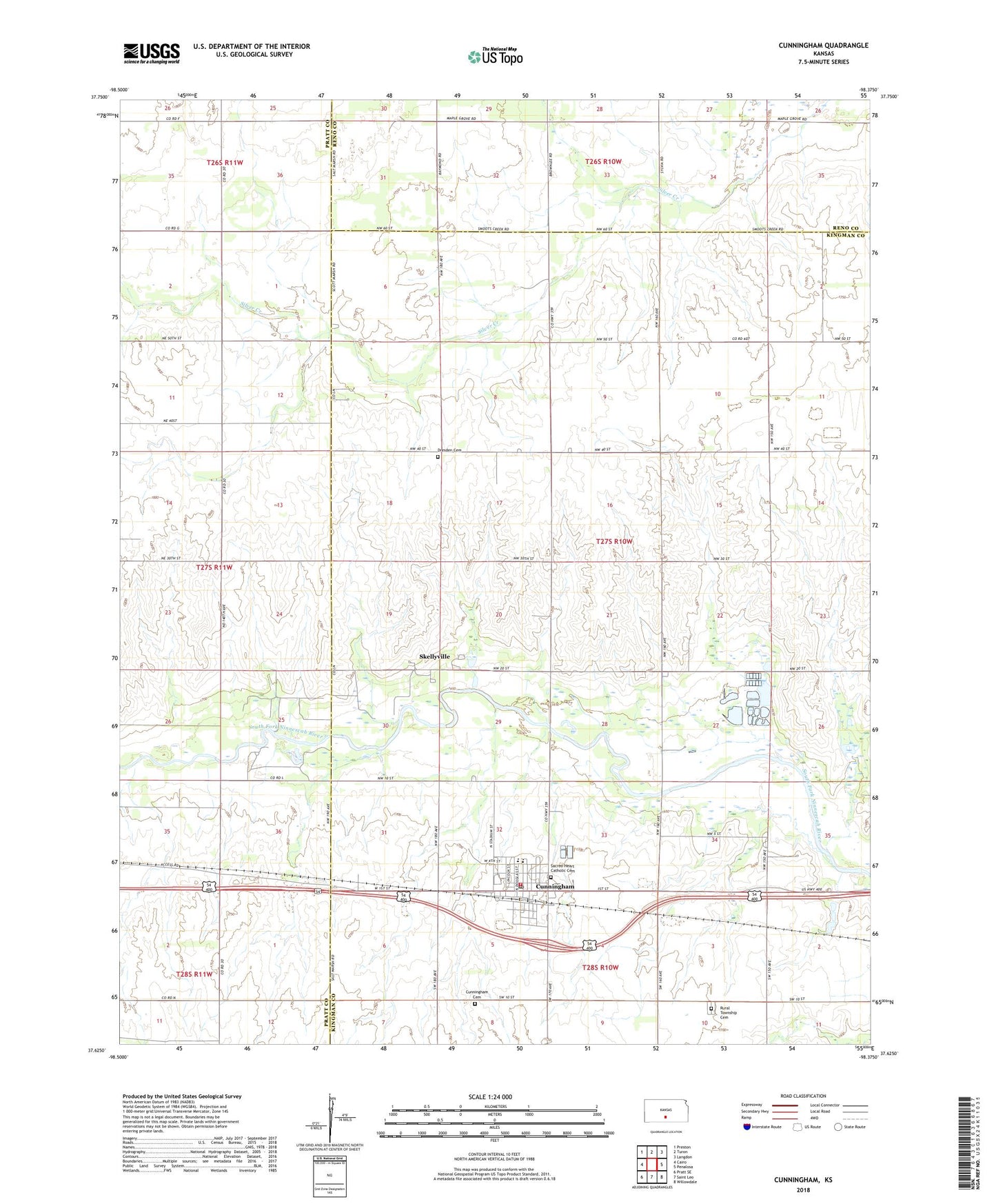
2022 topographic map quadrangle Cunningham in the state of Kansas. Scale: 1:24000. Based on the newly updated USGS 7.5' US Topo map series, this map is in the following counties: Kingman, Pratt, Reno. The map contains contour data, water features, and other items you are used to seeing on USGS maps, but also has updated roads and other features. This is the next generation of topographic maps. Printed on high-quality waterproof paper with UV fade-resistant inks.
Quads adjacent to this one:
West: Cairo
Northwest: Preston
North: Turon
Northeast: Langdon
East: Penalosa
Southeast: Willowdale
South: Saint Leo
Southwest: Pratt SE
This map covers the same area as the classic USGS quad with code o37098f4.
Contains the following named places: Artesian Valley School, City of Cunningham, Cunningham, Cunningham Cemetery, Cunningham Christian Church, Cunningham City Hall, Cunningham Community Center, Cunningham Elementary School, Cunningham Fire Department, Cunningham High School, Cunningham Museum, Cunningham Oil Field, Cunningham Post Office, Cunningham Public Library, Cunningham United Methodist Church, Cunningham Wastewater Treatment Plant, Dresden Cemetery, Green Acres Trailer Court, Maud Cemetery, Sacred Heart Catholic Cemetery, Sacred Heart Catholic Church, Skellyville, Township of Dresden, Union Star School, ZIP Code: 67035