MyTopo
Elsmore Kansas US Topo Map
Couldn't load pickup availability
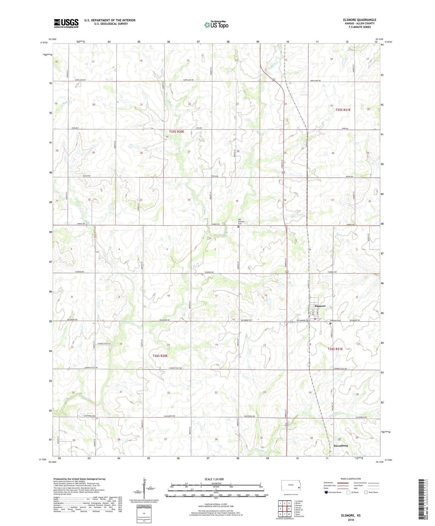
2022 topographic map quadrangle Elsmore in the state of Kansas. Scale: 1:24000. Based on the newly updated USGS 7.5' US Topo map series, this map is in the following counties: Allen. The map contains contour data, water features, and other items you are used to seeing on USGS maps, but also has updated roads and other features. This is the next generation of topographic maps. Printed on high-quality waterproof paper with UV fade-resistant inks.
Quads adjacent to this one:
West: Iola SE
Northwest: La Harpe
North: Moran
Northeast: Bronson
East: Moran SE
Southeast: Porterville
South: Stark
Southwest: Rollin
This map covers the same area as the classic USGS quad with code o37095g2.
Contains the following named places: Allen County Rural Fire District 3 Elsmore Station, City of Elsmore, East Liberty School, East Union School, Elsmore, Elsmore Cemetery, Elsmore Elementary School, Elsmore United Methodist Church, Elsmore Wastewater Plant, Little Creek, Mud Creek, Old Elsmore Cemetery, Old Elsmore School, Olive Branch School, Prairie Chapel Church, Prairie Rose Community Hall, Prairie Rose School, Savonburg Wastewater Treatment Plant, Sky Rocket School, Township of Elsmore, ZIP Codes: 66732, 66772