MyTopo
La Harpe Kansas US Topo Map
Couldn't load pickup availability
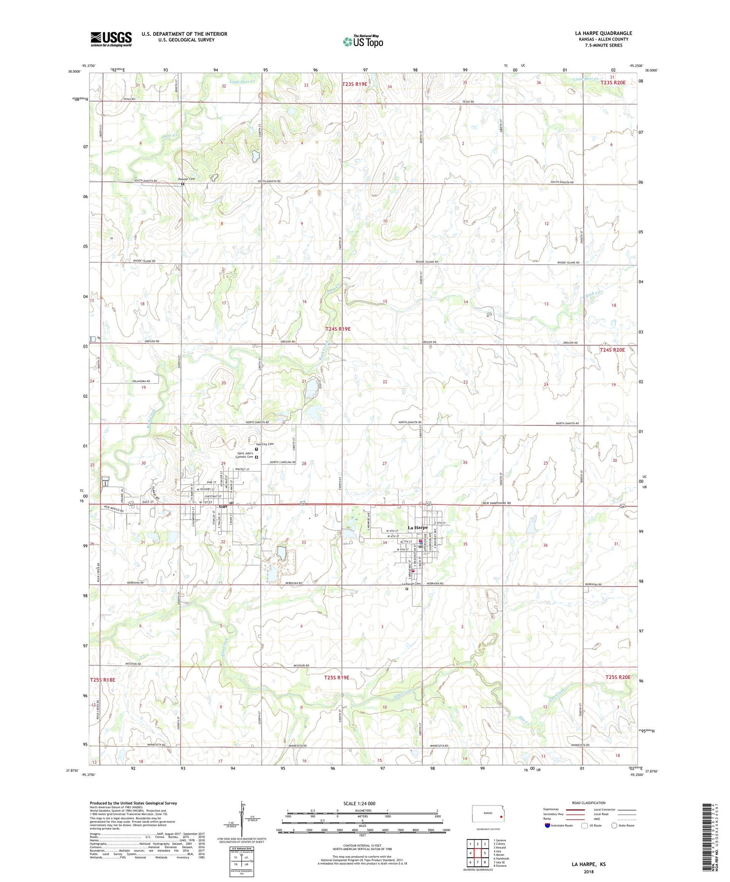
2022 topographic map quadrangle La Harpe in the state of Kansas. Scale: 1:24000. Based on the newly updated USGS 7.5' US Topo map series, this map is in the following counties: Allen. The map contains contour data, water features, and other items you are used to seeing on USGS maps, but also has updated roads and other features. This is the next generation of topographic maps. Printed on high-quality waterproof paper with UV fade-resistant inks.
Quads adjacent to this one:
West: Iola
Northwest: Geneva
North: Colony
Northeast: Kincaid
East: Moran
Southeast: Elsmore
South: Iola SE
Southwest: Humboldt
This map covers the same area as the classic USGS quad with code o37095h3.
Contains the following named places: Allen Center School, Allen County, Allen County Country Club, Allen County Landfill, City of Gas, City of La Harpe, Community of Christ, Deer Creek School, Elm Creek School, Gas, Gas City Cemetery, Gas City Hall, Gas Post Office, Independence School, Kingdom Hall of Jehovah's Witnesses, La Harpe, La Harpe Cemetery, La Harpe Christian Church, La Harpe City Hall, La Harpe Fire Department, La Harpe Police Department, La Harpe Post Office, La Harpe Rural Fire Department, La Harpe Senior Citizens Center, La Harpe Wastewater Plant, LaHarpe Elementary School, Little Deer Creek, Midway Air Park, National Airport, North Fairview School, Pioneer Cemetery, Rock Creek School, Saint John's Catholic Cemetery, Silver Leaf School, Spring Branch School, Township of Deer Creek, Township of Elm, Trailside Mobile Home Park, Trailside Mobile Home Village, Waverly School, Wise, ZIP Code: 66751