MyTopo
Moran SE Kansas US Topo Map
Couldn't load pickup availability
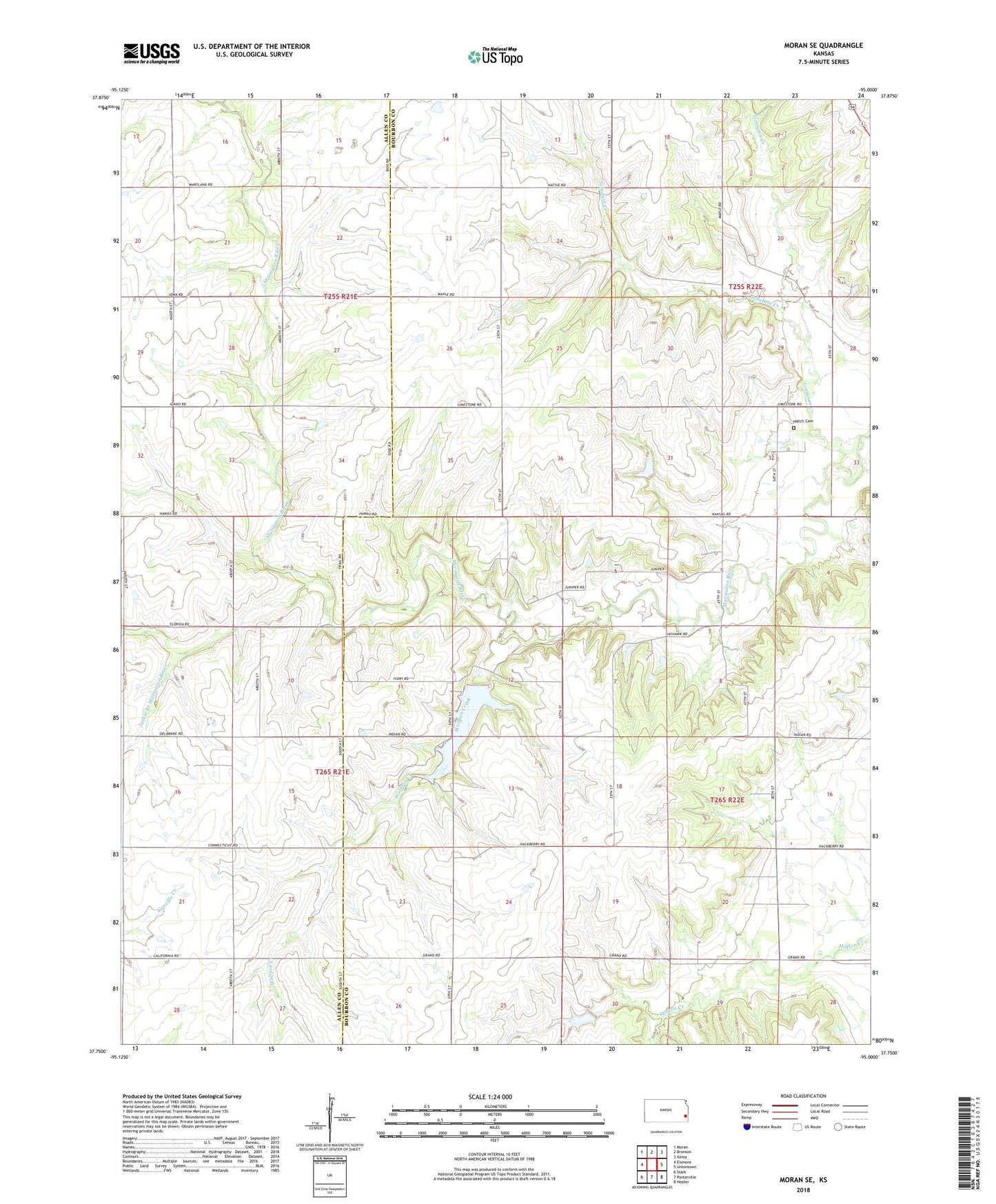
2022 topographic map quadrangle Moran SE in the state of Kansas. Scale: 1:24000. Based on the newly updated USGS 7.5' US Topo map series, this map is in the following counties: Bourbon, Allen. The map contains contour data, water features, and other items you are used to seeing on USGS maps, but also has updated roads and other features. This is the next generation of topographic maps. Printed on high-quality waterproof paper with UV fade-resistant inks.
Quads adjacent to this one:
West: Elsmore
Northwest: Moran
North: Bronson
Northeast: Xenia
East: Uniontown
Southeast: Hepler
South: Porterville
Southwest: Stark
This map covers the same area as the classic USGS quad with code o37095g1.
Contains the following named places: Blazing Star School, Bourbon County State Lake, Bourbon County State Lake Dam, Bourbon County State Park, Bourbon State Fishing Lake and Wildlife Refuge, Concord School, East Victory School, Hatch Cemetery, Jackie Branch Marmaton River, Moline School, Rockford, Rockford Post Office, Rocklow School, Rocky Point School, Schubert Creek, South Fairview Community Hall, South Fairview School, Sweet Branch, Tennyson Creek, West Bethel Community Hall, West Bethel School, Wolfpen Creek