MyTopo
Garden Plain Kansas US Topo Map
Couldn't load pickup availability
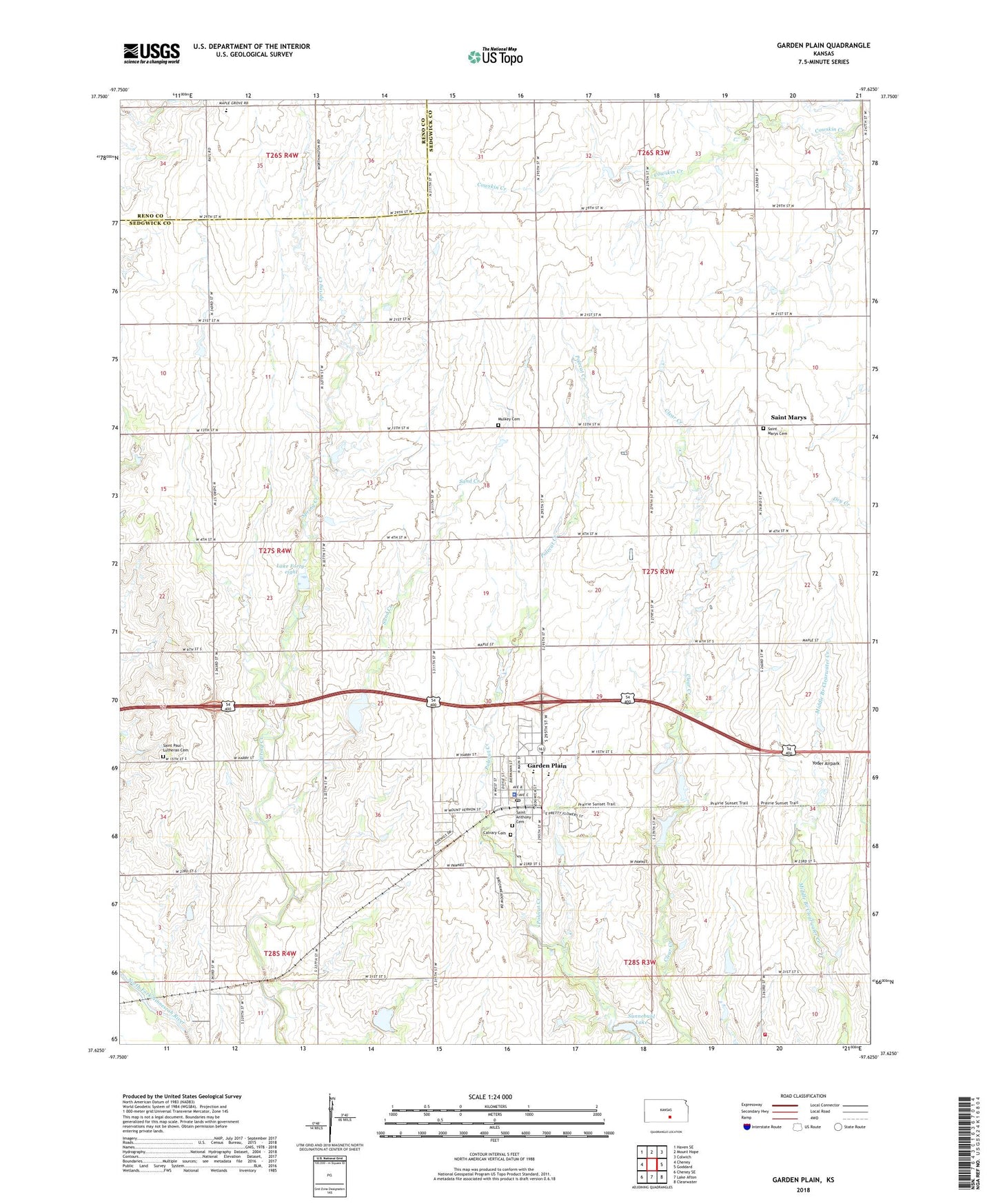
2022 topographic map quadrangle Garden Plain in the state of Kansas. Scale: 1:24000. Based on the newly updated USGS 7.5' US Topo map series, this map is in the following counties: Sedgwick, Reno. The map contains contour data, water features, and other items you are used to seeing on USGS maps, but also has updated roads and other features. This is the next generation of topographic maps. Printed on high-quality waterproof paper with UV fade-resistant inks.
Quads adjacent to this one:
West: Cheney
Northwest: Haven SE
North: Mount Hope
Northeast: Colwich
East: Goddard
Southeast: Clearwater
South: Lake Afton
Southwest: Cheney SE
This map covers the same area as the classic USGS quad with code o37097f6.
Contains the following named places: Birch, Calvary Cemetery, City of Garden Plain, Garden Plain, Garden Plain Community Church, Garden Plain Community Library, Garden Plain Elementary School, Garden Plain High School, Garden Plain Police Department, Garden Plain Post Office, Garden Plain Wastewater Treatment Plant, Lake Forty-eight, Mulkey Cemetery, Saint Anthony Cemetery, Saint Anthonys of Padua Catholic Church, Saint Joe, Saint Joseph Catholic School, Saint Marys, Saint Marys Cemetery, Saint Paul Lutheran Cemetery, Sand Creek, Sedgwick County Fire District 1 Station 39, Sunnebuhl Lake, Township of Garden Plain, Wetta Egg Farm, Yoder Airpark, ZIP Code: 67050