MyTopo
Cheney Kansas US Topo Map
Couldn't load pickup availability
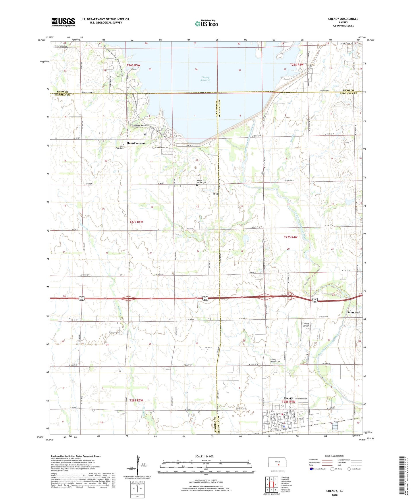
2022 topographic map quadrangle Cheney in the state of Kansas. Scale: 1:24000. Based on the newly updated USGS 7.5' US Topo map series, this map is in the following counties: Kingman, Sedgwick, Reno. The map contains contour data, water features, and other items you are used to seeing on USGS maps, but also has updated roads and other features. This is the next generation of topographic maps. Printed on high-quality waterproof paper with UV fade-resistant inks.
Quads adjacent to this one:
West: Waterloo
Northwest: Castleton
North: Haven SE
Northeast: Mount Hope
East: Garden Plain
Southeast: Lake Afton
South: Cheney SE
Southwest: Murdock
This map covers the same area as the classic USGS quad with code o37097f7.
Contains the following named places: Albers Airport, Bartholomew Oil Field, Bethel Church, Casley Gas and Oil Field, Cheney, Cheney Baptist Church, Cheney Dam, Cheney Elementary School, Cheney Golden Age Home, Cheney High School, Cheney Middle School, Cheney Police Department, Cheney Post Office, Cheney Public Library, Cheney State Park County Line Boat Ramp, Cheney State Park Giefer Hill Campground, Cheney State Park Harding Hill Campground, Cheney State Park Heimerman Point Campground, Cheney State Park Hobie Beach Campground, Cheney State Park M and M Point Campground, Cheney State Park Sailboat Cove Campground, Cheney State Park Smarsh Creek Campground, Cheney State Park West Boat Ramp, Cheney Volunteer Fire Department, Cheney Wastewater Plant, Cherry Oaks Golf Course, City of Cheney, Coombs Air Strip, Evan Mound School, Kansas Department of Wildlife and Parks Cheney State Park, Mount Vernon, Mount Vernon Cemetery, Pioneer Cemetery, Ritchey School, Rock Creek, Saint Paul, Saint Paul's Lutheran Church, Saint Paul's Lutheran School, Saint Rose Catholic Church, Saint Rose Cemetery, Suburban Mobile Home Park, Township of Evan, Township of Grand River, ZIP Code: 67025