MyTopo
Mount Hope Kansas US Topo Map
Couldn't load pickup availability
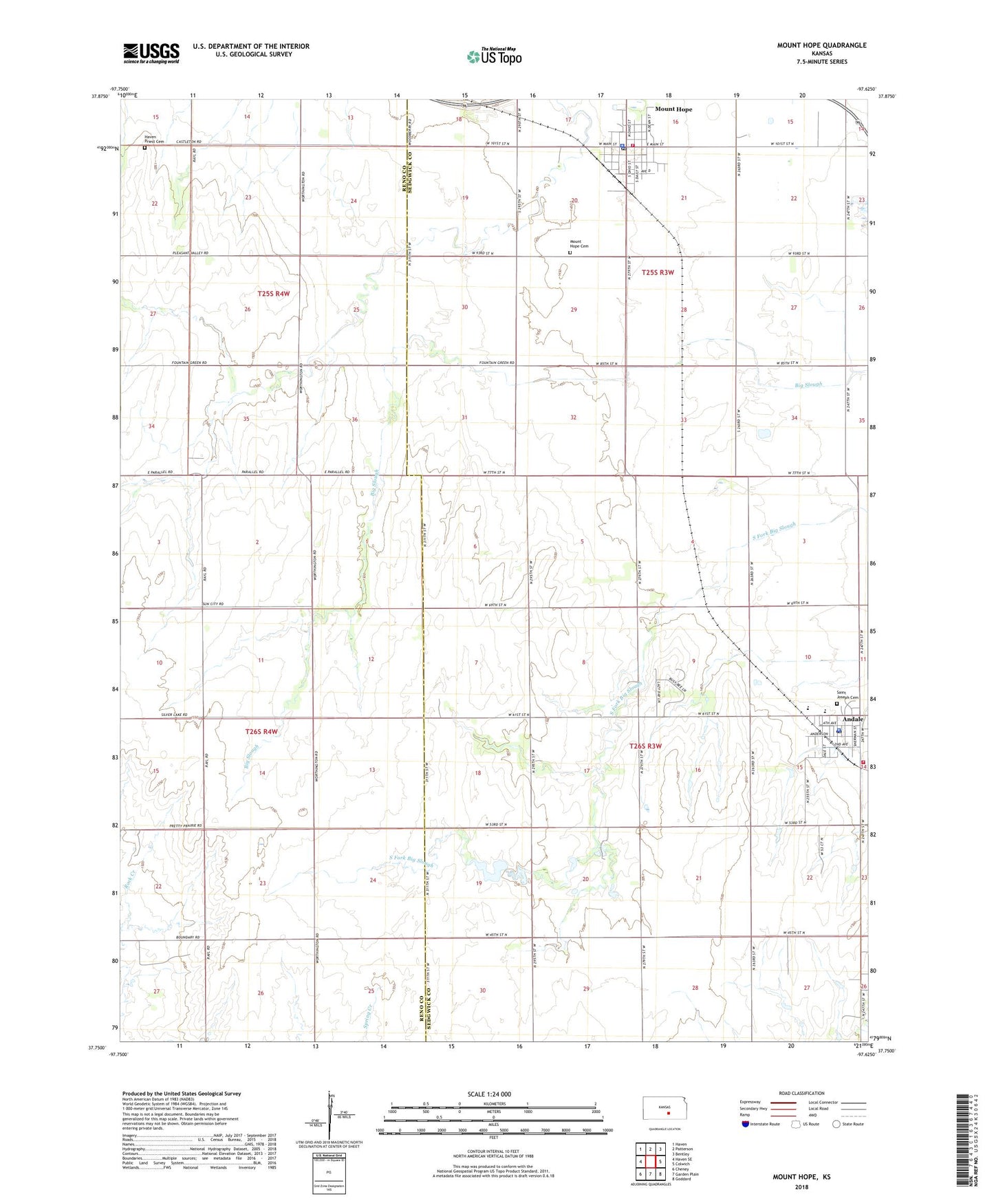
2022 topographic map quadrangle Mount Hope in the state of Kansas. Scale: 1:24000. Based on the newly updated USGS 7.5' US Topo map series, this map is in the following counties: Sedgwick, Reno. The map contains contour data, water features, and other items you are used to seeing on USGS maps, but also has updated roads and other features. This is the next generation of topographic maps. Printed on high-quality waterproof paper with UV fade-resistant inks.
Quads adjacent to this one:
West: Haven SE
Northwest: Haven
North: Patterson
Northeast: Bentley
East: Colwich
Southeast: Goddard
South: Garden Plain
Southwest: Cheney
This map covers the same area as the classic USGS quad with code o37097g6.
Contains the following named places: Andale, Andale Care Center, Andale Elementary - Middle School, Andale High School, Andale Middle School, Andale Police Department, Andale Post Office, Andale Water Tower, City of Andale, City of Mount Hope, Dicks Mobile Home Park, Haven Priest Cemetery, Mount Hope, Mount Hope Cemetery, Mount Hope City Offices, Mount Hope Community Ambulance Service, Mount Hope Elementary School, Mount Hope Federated Church, Mount Hope Fire Department, Mount Hope Municipal Court, Mount Hope Nursing Center, Mount Hope Police Department, Mount Hope Post Office, Mount Hope Public Library, Mount Hope United Methodist Church, Ost, Saint Joseph Cemetery, Sedgewick County Public Library - Andale District, Sedgwick County Fire District 1 Station 31, Team Marketing Alliance Grain Elevator Number 28, Township of Greeley, Township of Sherman, ZIP Codes: 67001, 67108