MyTopo
Mound City NW Kansas US Topo Map
Couldn't load pickup availability
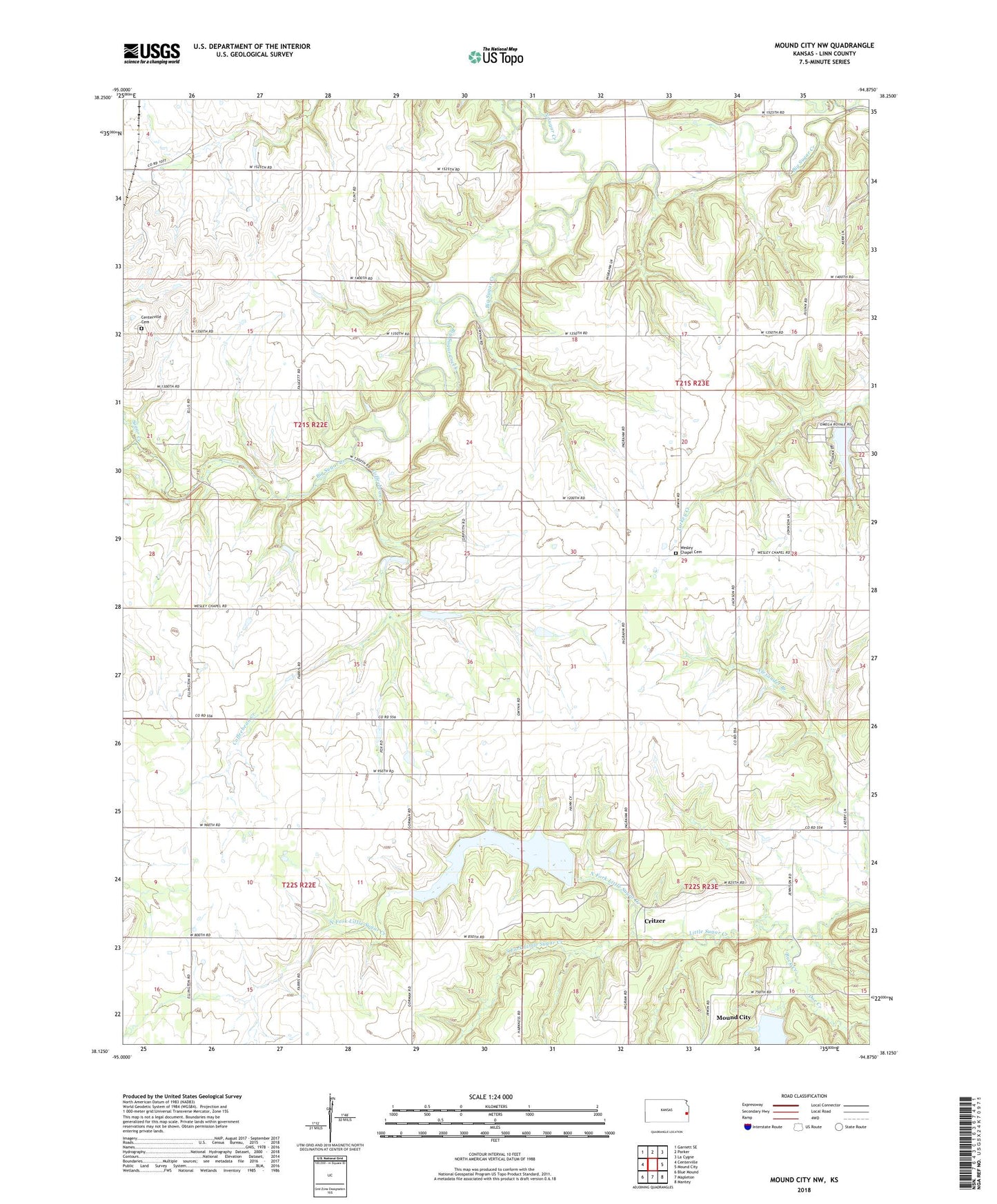
2022 topographic map quadrangle Mound City NW in the state of Kansas. Scale: 1:24000. Based on the newly updated USGS 7.5' US Topo map series, this map is in the following counties: Linn. The map contains contour data, water features, and other items you are used to seeing on USGS maps, but also has updated roads and other features. This is the next generation of topographic maps. Printed on high-quality waterproof paper with UV fade-resistant inks.
Quads adjacent to this one:
West: Centerville
Northwest: Garnett SE
North: Parker
Northeast: La Cygne
East: Mound City
Southeast: Mantey
South: Mapleton
Southwest: Blue Mound
This map covers the same area as the classic USGS quad with code o38094b8.
Contains the following named places: Buck Creek, Centerville Cemetery, Coffeebean Creek, Critzer, Davis Creek, Doe Creek, Lake Chaparral, Lake Chaparral Dam, North Fork Little Sugar Creek, North Sugar Creek, South Fork Little Sugar Creek, South Fork Sugar Creek, Sugar Creek, Township of Centerville, Wall Street, Wall Street Church, Wesley Chapel, Wesley Chapel Cemetery, ZIP Code: 66014