MyTopo
Hammond Kansas US Topo Map
Couldn't load pickup availability
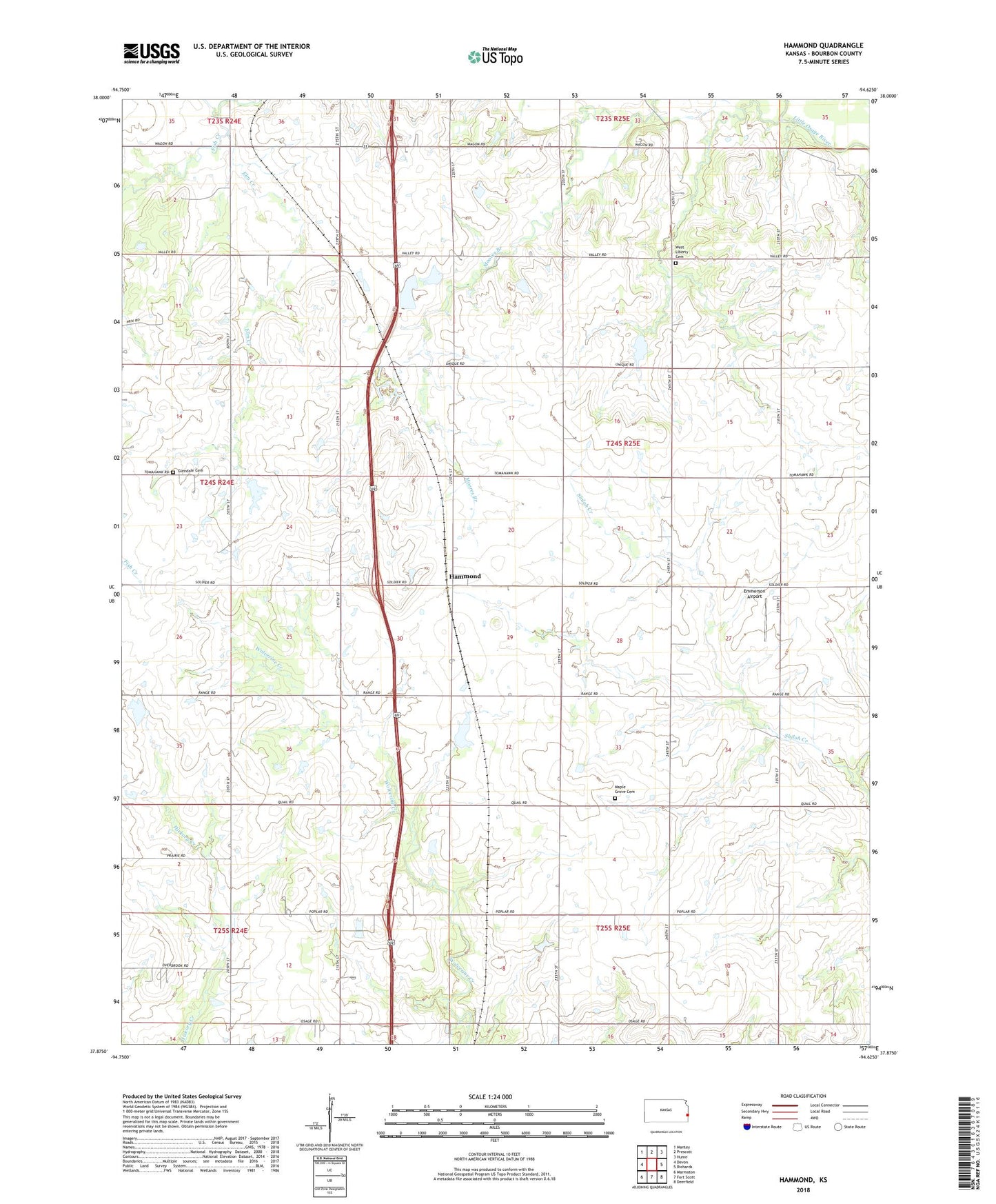
2022 topographic map quadrangle Hammond in the state of Kansas. Scale: 1:24000. Based on the newly updated USGS 7.5' US Topo map series, this map is in the following counties: Bourbon. The map contains contour data, water features, and other items you are used to seeing on USGS maps, but also has updated roads and other features. This is the next generation of topographic maps. Printed on high-quality waterproof paper with UV fade-resistant inks.
Quads adjacent to this one:
West: Devon
Northwest: Mantey
North: Prescott
Northeast: Hume
East: Richards
Southeast: Deerfield
South: Fort Scott
Southwest: Marmaton
This map covers the same area as the classic USGS quad with code o37094h6.
Contains the following named places: Banner School, Bunker Hill School, Center School, Elm Creek, Emmerson Airport, Glendale, Glendale Cemetery, Glendale School, Hammond, KVCY - FM (Fort Scott), Ludlow School, Lyons Field, Maple Grove Cemetery, Maple Grove School, Ruble School, Shiloh School, Township of Osage, Union Center School, West Liberty Cemetery, West Liberty School, West Liberty United Methodist Church, York Center School