MyTopo
Devon Kansas US Topo Map
Couldn't load pickup availability
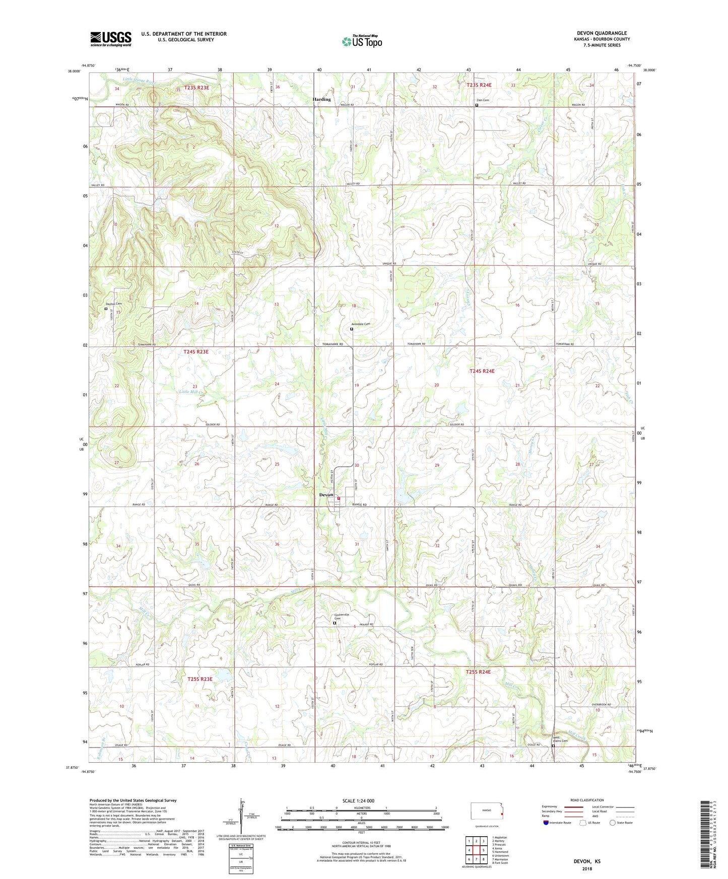
2022 topographic map quadrangle Devon in the state of Kansas. Scale: 1:24000. Based on the newly updated USGS 7.5' US Topo map series, this map is in the following counties: Bourbon. The map contains contour data, water features, and other items you are used to seeing on USGS maps, but also has updated roads and other features. This is the next generation of topographic maps. Printed on high-quality waterproof paper with UV fade-resistant inks.
Quads adjacent to this one:
West: Xenia
Northwest: Mapleton
North: Mantey
Northeast: Prescott
East: Hammond
Southeast: Fort Scott
South: Marmaton
Southwest: Uniontown
This map covers the same area as the classic USGS quad with code o37094h7.
Contains the following named places: Avondale Cemetery, Avondale School, Bourbon County Fire District 3 Station 5, Centerville Cemetery, Centerville Church, Centerville School, Crescent School, Dayton, Dayton Cemetery, Dayton School, Devon, Devon Census Designated Place, Devon Community Center, Fairmount School, Fish Creek School, Forestdale School, Harding, Honey Creek, KOMB - FM (Fort Scott), Little Mill Creek, Pleasant Valley School, Rock School, Township of Freedom, Township of Mill Creek, West Plains Cemetery, Zion Cemetery, Zion School