MyTopo
Hume Missouri US Topo Map
Couldn't load pickup availability
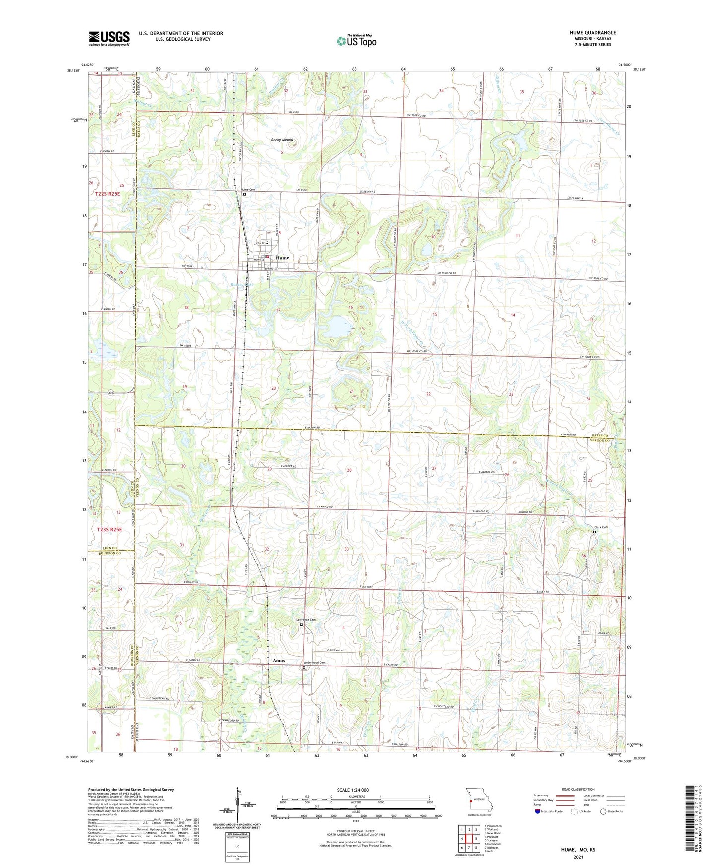
2021 topographic map quadrangle Hume in the state of Missouri. Scale: 1:24000. Based on the newly updated USGS 7.5' US Topo map series, this map is in the following counties: Bates, Vernon, Linn, Bourbon. The map contains contour data, water features, and other items you are used to seeing on USGS maps, but also has updated roads and other features. This is the next generation of topographic maps. Printed on high-quality waterproof paper with UV fade-resistant inks.
Quads adjacent to this one:
West: Prescott
Northwest: Pleasanton
North: Worland
Northeast: New Home
East: Sprague
Southeast: Metz
South: Richards
Southwest: Hammond
This map covers the same area as the classic USGS quad with code o38094a5.
Contains the following named places: Amos, Amos School, Brush College School, Centerview Church, Clark Cemetery, Hume, Hume Cemetery, Hume Elementary School, Hume Fire Department, Hume High School, Hume Post Office, Lawrence Cemetery, Mount Leonard School, Mount Rose School, New Home Junction, Prairie Union School, Rainey Lake, Rock, Rock Post Office, Rocky Mound, Rose-Leonard School, Stony Point School, Tolley Creek, Town of Hume, Township of Henry, Township of Howard, Underwood Cemetery, Union Chapel, Wolf School, Wolfe, Wolfe Post Office, ZIP Code: 64752