MyTopo
Prescott Kansas US Topo Map
Couldn't load pickup availability
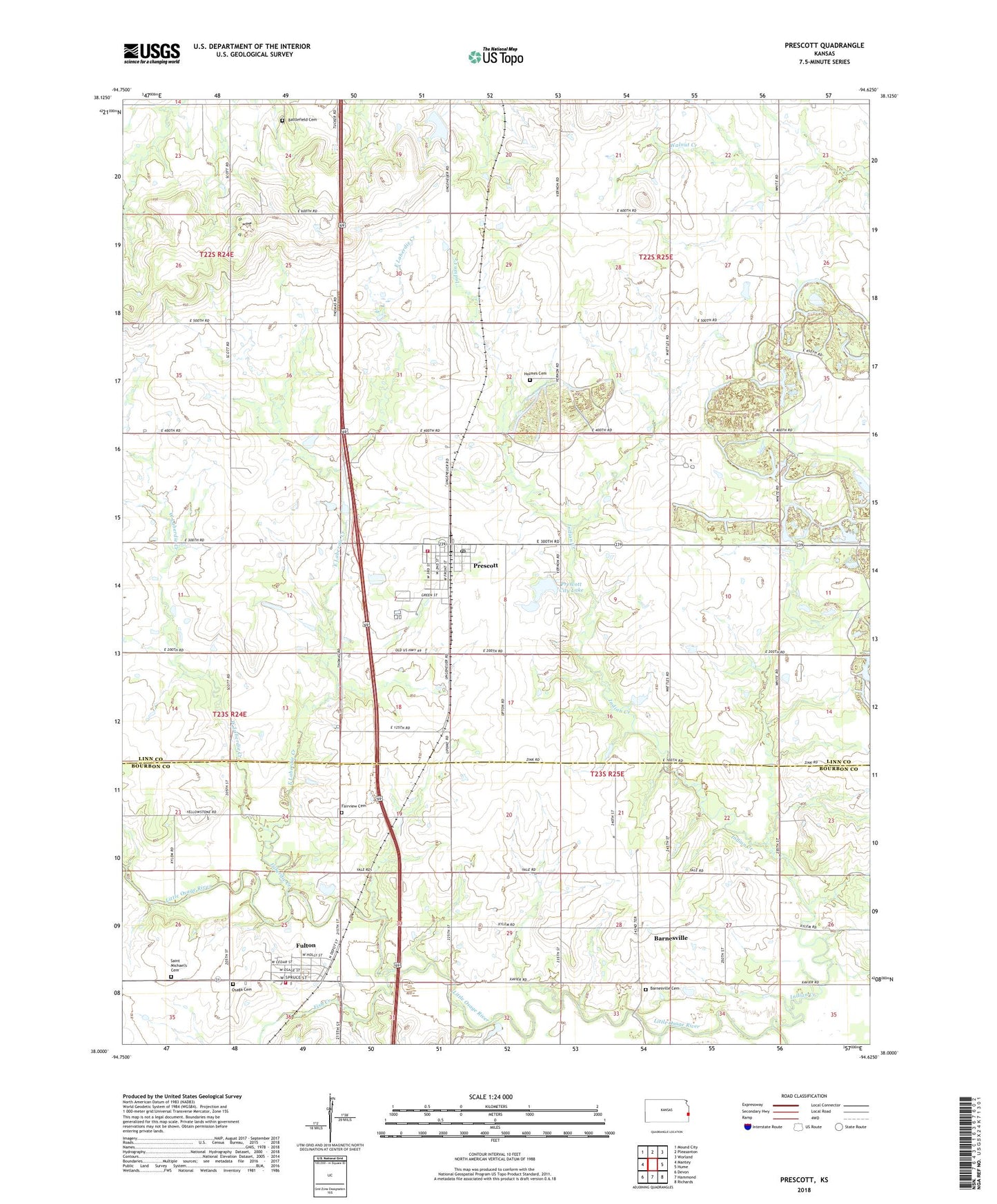
2022 topographic map quadrangle Prescott in the state of Kansas. Scale: 1:24000. Based on the newly updated USGS 7.5' US Topo map series, this map is in the following counties: Linn, Bourbon. The map contains contour data, water features, and other items you are used to seeing on USGS maps, but also has updated roads and other features. This is the next generation of topographic maps. Printed on high-quality waterproof paper with UV fade-resistant inks.
Quads adjacent to this one:
West: Mantey
Northwest: Mound City
North: Pleasanton
Northeast: Worland
East: Hume
Southeast: Richards
South: Hammond
Southwest: Devon
This map covers the same area as the classic USGS quad with code o38094a6.
Contains the following named places: Barnesville, Barnesville Cemetery, Battlefield Cemetery, Bourbon County Fire District 3 Station 3, City of Fulton, City of Prescott, East Laberdie Creek, Faber Park, Fairview Cemetery, Fish Creek, Fulton, Fulton Community Center, Fulton United Methodist Church, Fulton Wastewater Treatment Plant, Garfield School, Holmes Cemetery, Indian Creek, Indian Creek School, Laberdie Creek, Linn County Rural Fire District 1 Station 960, Martin School, Miami, Moores Branch, Osaga Cemetery, Prescott, Prescott Baptist Church, Prescott City Dam, Prescott City Hall, Prescott City Lake, Prescott City Library, Prescott Elementary School, Prescott Post Office, Prescott Sewer Treatment Plant, Prescott Transfer Station and Construction Debris Landfill, Prescott United Methodist Church, Saint Michael's Cemetery, Township of Sheridan, Walnut Valley School, West Laberdie Creek, ZIP Codes: 66738, 66767