MyTopo
Kincaid Kansas US Topo Map
Couldn't load pickup availability
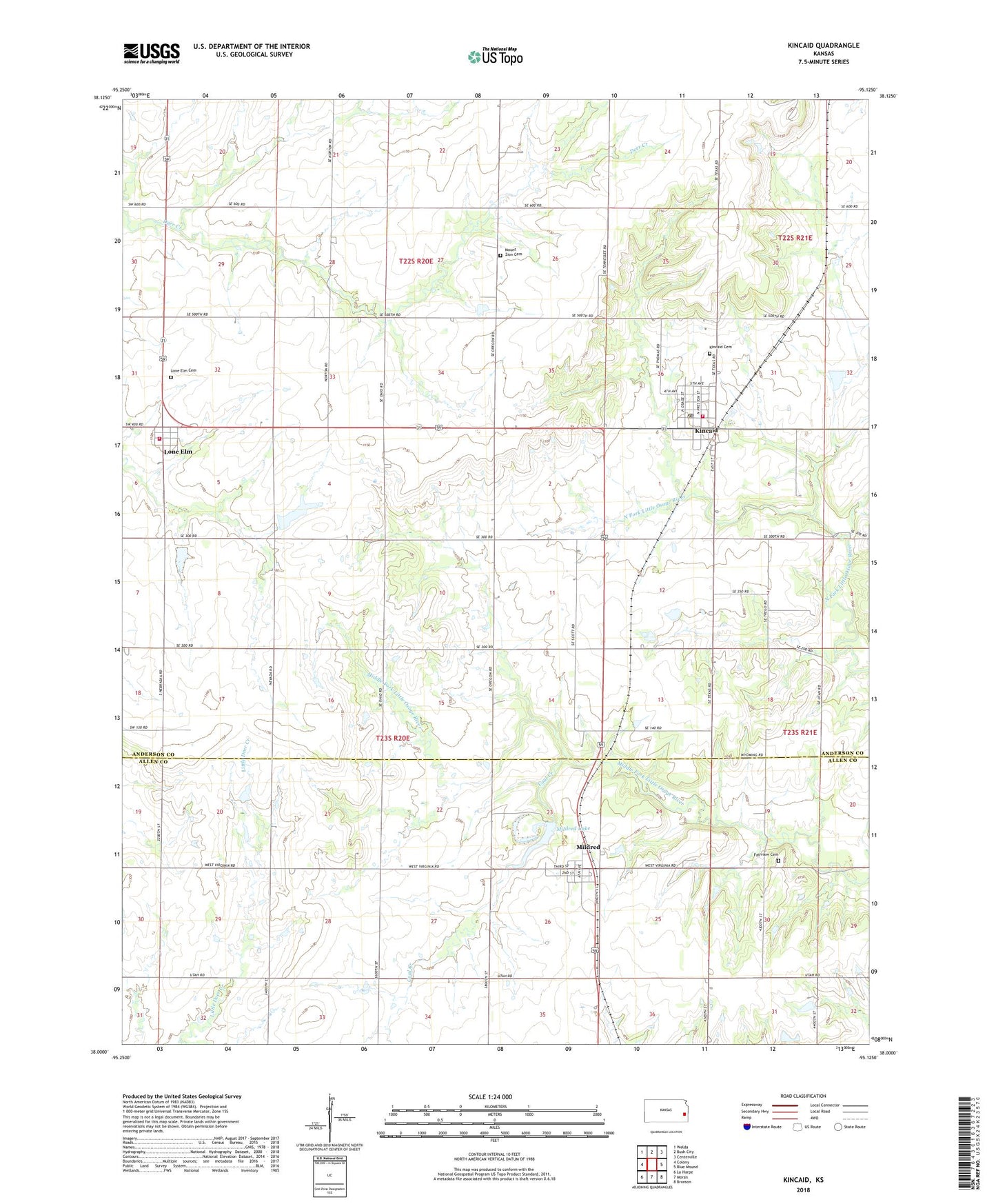
2022 topographic map quadrangle Kincaid in the state of Kansas. Scale: 1:24000. Based on the newly updated USGS 7.5' US Topo map series, this map is in the following counties: Anderson, Allen. The map contains contour data, water features, and other items you are used to seeing on USGS maps, but also has updated roads and other features. This is the next generation of topographic maps. Printed on high-quality waterproof paper with UV fade-resistant inks.
Quads adjacent to this one:
West: Colony
Northwest: Welda
North: Bush City
Northeast: Centerville
East: Blue Mound
Southeast: Bronson
South: Moran
Southwest: La Harpe
This map covers the same area as the classic USGS quad with code o38095a2.
Contains the following named places: Beachner Grain Elevator Number 23, City of Kincaid, City of Lone Elm, City of Mildred, Coal Creek, Crest East Elementary School, Equity, Fairview Cemetery, Fairview Chapel, Kincaid, Kincaid Cemetery, Kincaid City Marshal's Office, Kincaid Fire Department - Lone Elm Station, Kincaid Fire Station, Kincaid Post Office, Kincaid United Methodist Church, Kincaid Wastewater Plant, Lone Elm, Lone Elm Cemetery, Mildred, Mildred Census Designated Place, Mildred Lake, Mildred Lake Dam, Mildred United Methodist Church, Mount Zion Cemetery, Township of Lone Elm, Township of Rich, ZIP Code: 66039