MyTopo
Blue Mound Kansas US Topo Map
Couldn't load pickup availability
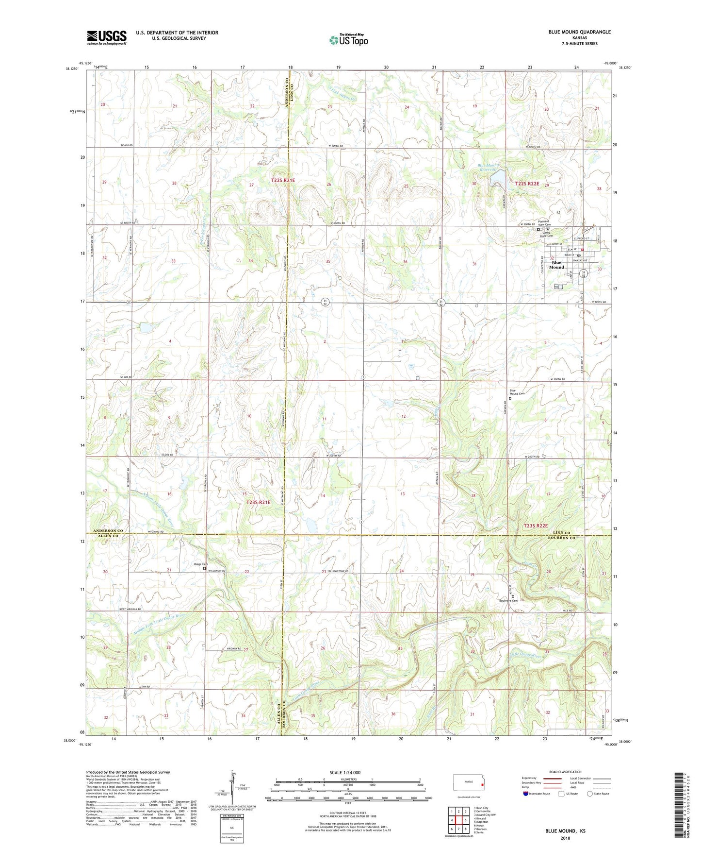
2022 topographic map quadrangle Blue Mound in the state of Kansas. Scale: 1:24000. Based on the newly updated USGS 7.5' US Topo map series, this map is in the following counties: Linn, Anderson, Bourbon, Allen. The map contains contour data, water features, and other items you are used to seeing on USGS maps, but also has updated roads and other features. This is the next generation of topographic maps. Printed on high-quality waterproof paper with UV fade-resistant inks.
Quads adjacent to this one:
West: Kincaid
Northwest: Bush City
North: Centerville
Northeast: Mound City NW
East: Mapleton
Southeast: Xenia
South: Bronson
Southwest: Moran
This map covers the same area as the classic USGS quad with code o38095a1.
Contains the following named places: Blue Mound, Blue Mound Elementary School, Blue Mound Municipal Water Treatment Facility, Blue Mound Post Office, Blue Mound Reservoir, Blue Mound United Methodist Church, Boulware Cemetery, City of Blue Mound, Glendale School, Irish Creek, Laura, Linn County Library District Number 3, Linn County Rural Fire District 1 Station 970, Middle Fork Little Osage River, Mount Sterling School, North Fork Little Osage River, Old Blue Mound Cemetery, Osage Valley Cemetery, Pleasant View Cemetery, Rocky Point School, Ross Branch, South Fork Little Osage River, Sunny Slope Cemetery, Township of Blue Mound