MyTopo
Welda Kansas US Topo Map
Couldn't load pickup availability
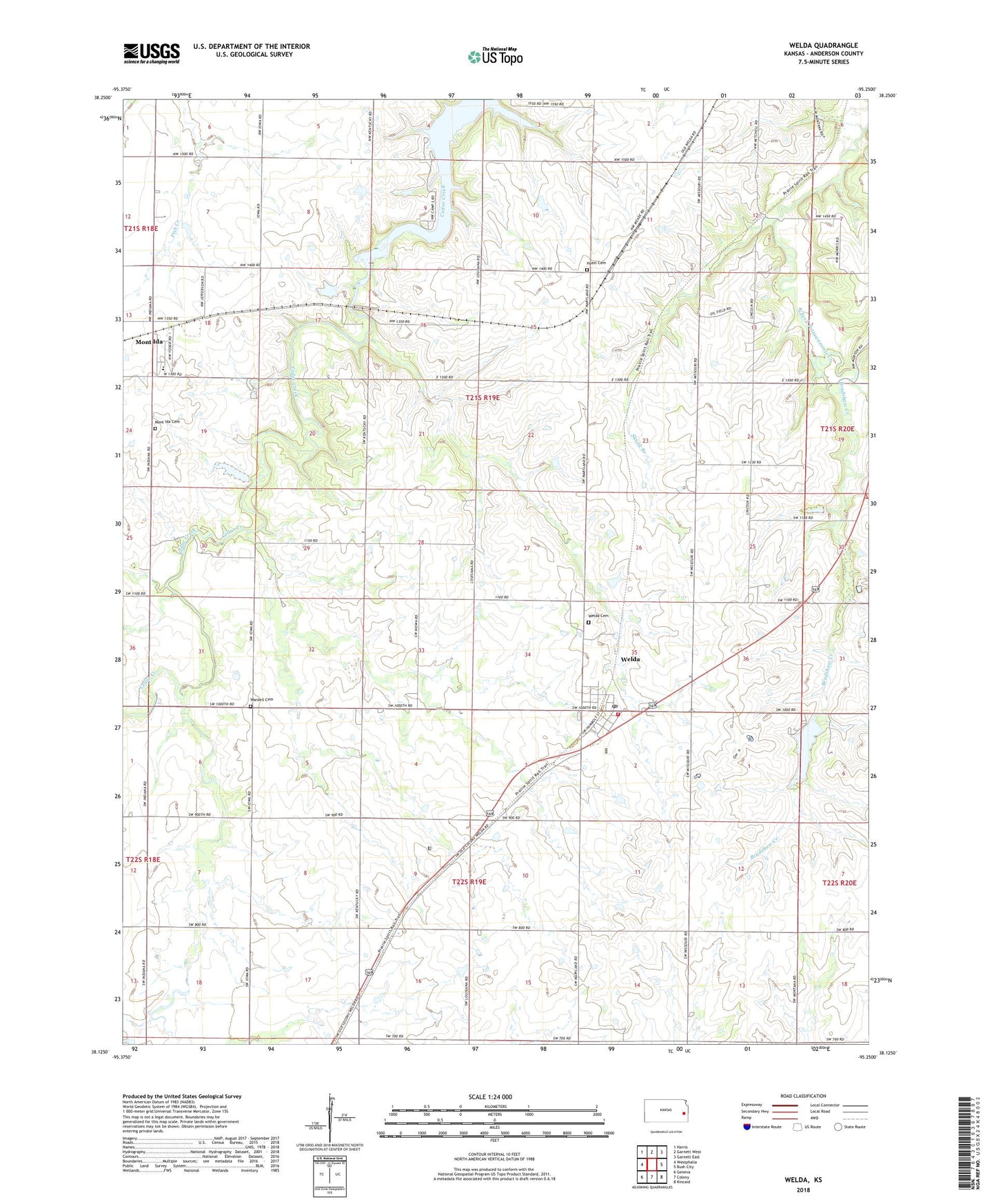
2022 topographic map quadrangle Welda in the state of Kansas. Scale: 1:24000. Based on the newly updated USGS 7.5' US Topo map series, this map is in the following counties: Anderson. The map contains contour data, water features, and other items you are used to seeing on USGS maps, but also has updated roads and other features. This is the next generation of topographic maps. Printed on high-quality waterproof paper with UV fade-resistant inks.
Quads adjacent to this one:
West: Westphalia
Northwest: Harris
North: Garnett West
Northeast: Garnett East
East: Bush City
Southeast: Kincaid
South: Colony
Southwest: Geneva
This map covers the same area as the classic USGS quad with code o38095b3.
Contains the following named places: Anderson County, Bradshaw Creek, Cedar Valley Reservoir, Hyatt Cemetery, Hyattville, Lake Welda, Mont Ida, Mont Ida Cemetery, Mont Ida Census Designated Place, Mont Ida Elementary School, Rolling Ball Ranch, Skunk Branch, Township of Washington, Township of Welda, Wardell Cemetery, Washington School, Welda, Welda Cemetery, Welda Census Designated Place, Welda Post Office, Welda Sewer District Number 1, Welda United Methodist Church, Welda Volunteer Fire Department, ZIP Code: 66091