MyTopo
Liebenthal Kansas US Topo Map
Couldn't load pickup availability
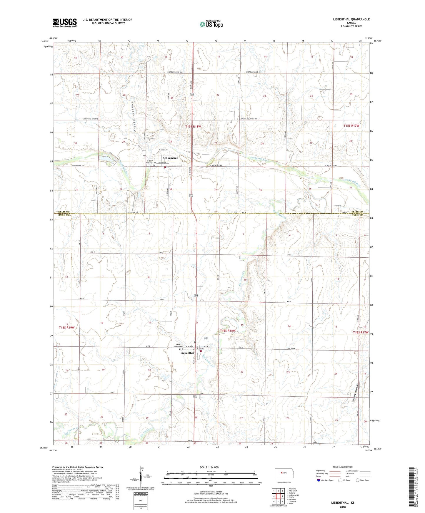
2022 topographic map quadrangle Liebenthal in the state of Kansas. Scale: 1:24000. Based on the newly updated USGS 7.5' US Topo map series, this map is in the following counties: Rush, Ellis. The map contains contour data, water features, and other items you are used to seeing on USGS maps, but also has updated roads and other features. This is the next generation of topographic maps. Printed on high-quality waterproof paper with UV fade-resistant inks.
Quads adjacent to this one:
West: La Crosse NW
Northwest: Antonino
North: Hays South
Northeast: Victoria
East: Pfeifer
Southeast: Bison
South: La Crosse
Southwest: Hargrave
This map covers the same area as the classic USGS quad with code o38099f3.
Contains the following named places: Big Timber Creek, City of Liebenthal, City of Schoenchen, Dusty Glassman Ballfields, Ellis County Rural Fire Department 8, Liebenthal, Liebenthal Post Office, Liebenthal Wastewater Plant, Lookout Hollow, Rush County Fire District 6 Liebenthal, Saint Anthony Cemetery, Saint Joseph Cemetery, Saint Joseph's Catholic Church, Schoenchen, Schoenchen Elementary School, Schoenchen Wastewater Plant, Township of Big Timber, ZIP Codes: 67553, 67667