MyTopo
Morehead Kansas US Topo Map
Couldn't load pickup availability
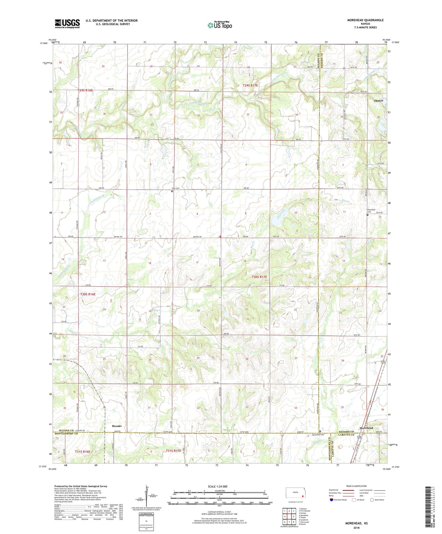
2022 topographic map quadrangle Morehead in the state of Kansas. Scale: 1:24000. Based on the newly updated USGS 7.5' US Topo map series, this map is in the following counties: Wilson, Neosho, Montgomery, Labette. The map contains contour data, water features, and other items you are used to seeing on USGS maps, but also has updated roads and other features. This is the next generation of topographic maps. Printed on high-quality waterproof paper with UV fade-resistant inks.
Quads adjacent to this one:
West: Neodesha
Northwest: Altoona
North: Five Mounds
Northeast: Earlton
East: Thayer
Southeast: Dennis
South: Cherryvale
Southwest: Sycamore
This map covers the same area as the classic USGS quad with code o37095d5.
Contains the following named places: Big Four School, Brooks, Harrison Church, Hidden Haven Camp, Little Chetopa Creek, Morehead, Morehead Cemetery, Newark, Plainfield Cemetery, Star Cemetery, Township of Newark, Wilson County Rural Fire District Station 11