MyTopo
Cherryvale Kansas US Topo Map
Couldn't load pickup availability
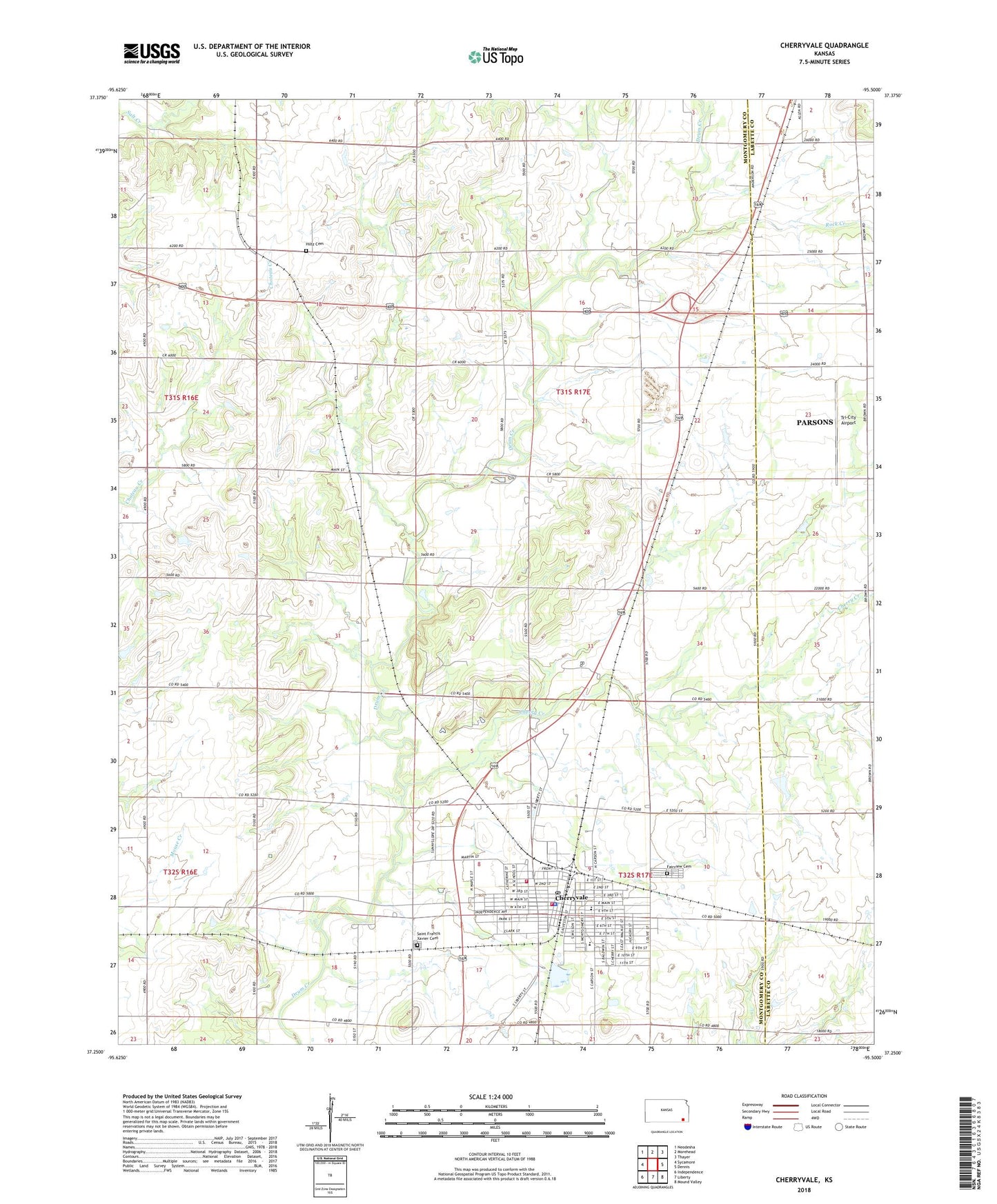
2022 topographic map quadrangle Cherryvale in the state of Kansas. Scale: 1:24000. Based on the newly updated USGS 7.5' US Topo map series, this map is in the following counties: Montgomery, Labette. The map contains contour data, water features, and other items you are used to seeing on USGS maps, but also has updated roads and other features. This is the next generation of topographic maps. Printed on high-quality waterproof paper with UV fade-resistant inks.
Quads adjacent to this one:
West: Sycamore
Northwest: Neodesha
North: Morehead
Northeast: Thayer
East: Dennis
Southeast: Mound Valley
South: Liberty
Southwest: Independence
This map covers the same area as the classic USGS quad with code o37095c5.
Contains the following named places: Bible Holiness Church, Cherry Creek, Cherry School, Cherryvale, Cherryvale Assembly of God Church, Cherryvale Christian Church, Cherryvale City Hall, Cherryvale City Lake Dam, Cherryvale Fire Department, Cherryvale Middle / High School, Cherryvale Museum, Cherryvale Police Department, Cherryvale Post Office, Cherryvale Public Library, Cherryvale United Methodist Church, Cherryvale Wastewater Plant, Church of the Nazarene, City of Cherryvale, Corbin, Fairview Cemetery, First Baptist Church, First Presbyterian Church, First Southern Baptist Church, Hanley School, Hazel Dell Church, Hiltz Cemetery, Howard School, Kansas Department of Transportation Montgomery County Rest Area, Lincoln Central Elementary School, Logan Park, McKinley Elementary School, Montgomery County Rural Fire District Station 4, New Life Praise and Worship Church, Peoples School, Pleasant Dale Church, Pleasant Dale School, Racob School, Rock Creek, Saint Francis Xavier Catholic Church, Saint Francis Xavier Cemetery, Saint Johns School, Township of Cherry, Tri-City Airport, Wetzel School, ZIP Code: 67335