MyTopo
Altoona Kansas US Topo Map
Couldn't load pickup availability
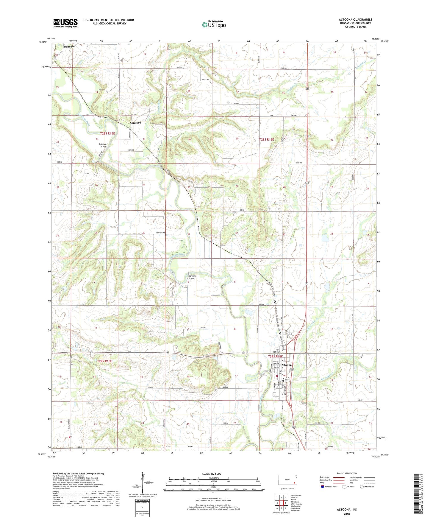
2022 topographic map quadrangle Altoona in the state of Kansas. Scale: 1:24000. Based on the newly updated USGS 7.5' US Topo map series, this map is in the following counties: Wilson. The map contains contour data, water features, and other items you are used to seeing on USGS maps, but also has updated roads and other features. This is the next generation of topographic maps. Printed on high-quality waterproof paper with UV fade-resistant inks.
Quads adjacent to this one:
West: Fredonia
Northwest: Middletown
North: Buffalo
Northeast: Vilas
East: Five Mounds
Southeast: Morehead
South: Neodesha
Southwest: Lafontaine
This map covers the same area as the classic USGS quad with code o37095e6.
Contains the following named places: Altoona, Altoona - Midway Elementary School, Altoona City Hall, Altoona Fire Department, Altoona Post Office, Altoona Public Library, Altoona Sewer Treatment Plant, Baker Valley School, Barnhill Bridge, Big Cedar Creek, Camp Cauble, City of Altoona, Crooked Creek, Excelsior School, Fairview School, First Baptist Church, Guilford, Guilford Bridge, Harmony School, Hatler School, Kelley School, Little Cedar Creek, Olive Branch School, Omega School, Township of Cedar, Township of Guilford, Verdigris Valley Christian Fellowship, Wilson County, Wilson County Rural Fire District Station 6