MyTopo
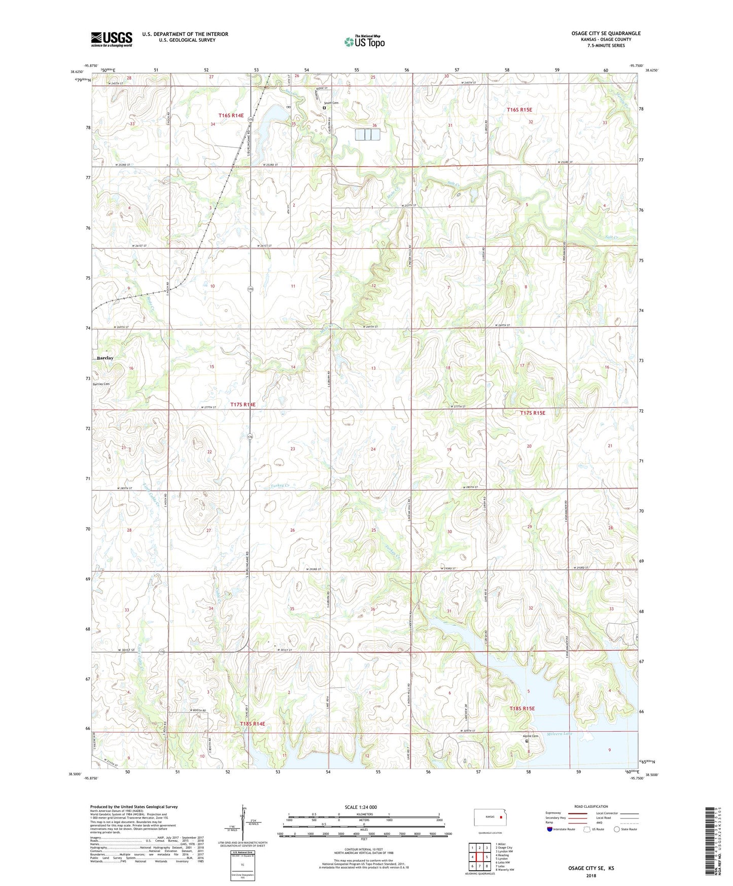
Osage City SE Kansas US Topo Map
Couldn't load pickup availability
2022 topographic map quadrangle Osage City SE in the state of Kansas. Scale: 1:24000. Based on the newly updated USGS 7.5' US Topo map series, this map is in the following counties: Osage. The map contains contour data, water features, and other items you are used to seeing on USGS maps, but also has updated roads and other features. This is the next generation of topographic maps. Printed on high-quality waterproof paper with UV fade-resistant inks.
Quads adjacent to this one:
West: Reading
Northwest: Miller
North: Osage City
Northeast: Lyndon NW
East: Lyndon
Southeast: Waverly NW
South: Lebo
Southwest: Lebo NW
This map covers the same area as the classic USGS quad with code o38095e7.
Contains the following named places: Alpine Cemetery, Craig City, Eisenhower State Park Cowboy Campground, Mute Creek, Osage City Baptist Temple, Osage City Dam, Osage City Municipal Golf Course, Osage City Reservoir, Osage City Wastewater Treatment Plant, South Cemetery, Turkey Creek, ZIP Code: 66523