MyTopo
Lyndon Kansas US Topo Map
Couldn't load pickup availability
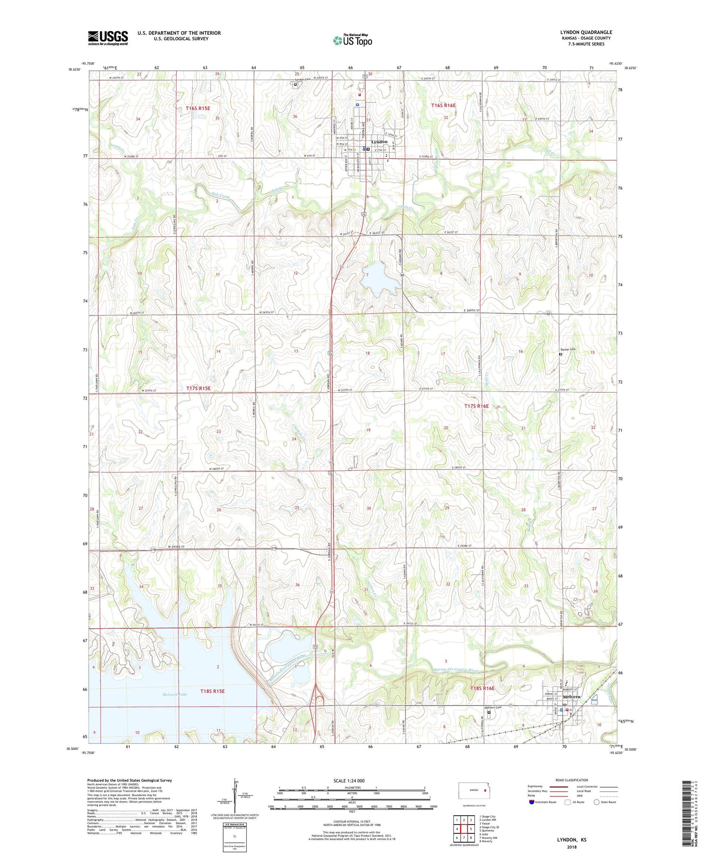
2022 topographic map quadrangle Lyndon in the state of Kansas. Scale: 1:24000. Based on the newly updated USGS 7.5' US Topo map series, this map is in the following counties: Osage. The map contains contour data, water features, and other items you are used to seeing on USGS maps, but also has updated roads and other features. This is the next generation of topographic maps. Printed on high-quality waterproof paper with UV fade-resistant inks.
Quads adjacent to this one:
West: Osage City SE
Northwest: Osage City
North: Lyndon NW
Northeast: Vassar
East: Quenemo
Southeast: Waverly
South: Waverly NW
Southwest: Lebo
This map covers the same area as the classic USGS quad with code o38095e6.
Contains the following named places: Chicken Creek, City of Lyndon, City of Melvern, Danish Cemetery, Eisenhower State Park Abilene Campground, Eisenhower State Park Blackjack Campground, Eisenhower State Park Churchill Campground, Eisenhower State Park Doud Campground, Eisenhower State Park Fivestar Campground, Eisenhower State Park Rangers Office, Eisenhower State Park Sailboat Beach Campground, Eisenhower State Park Westpoint Campground, First Baptist Church, First Church of God, Hilltop Nursing Home, Jersey Creek, Kansas Highway Patrol Troop B Osage, Lyndon, Lyndon Amish Mennonite Church, Lyndon Assembly of God Church, Lyndon Carnegie Library, Lyndon Cemetery, Lyndon City Dam, Lyndon City Hall, Lyndon Community Center, Lyndon Elementary / Middle School, Lyndon Fellowship Bible Church, Lyndon High School, Lyndon Police Department, Lyndon Post Office, Lyndon Unified School District Office, Lyndon United Methodist Church, Lyndon Wastewater Plant, Marais Des Cygnes Valley High School, Marais Des Cygnes Valley Middle School, Marais Des Cygnes Valley Unified School District Office, Melvena Wildlife Area, Melvern, Melvern Cemetery, Melvern City Hall, Melvern City Park Fairgrounds, Melvern Community Center, Melvern Dam, Melvern Police Department, Melvern Post Office, Melvern Sewer Treatment Plant, Melvern State Park, Melvern United Methodist Church, Mount Pleasant Community Church, Osage County Courthouse, Osage County Fire District 3 Melvern, Osage County Fire District 5 Lyndon Station, Osage County Health Department, Osage County Historical Society Museum, Osage County Jail, Osage County Sheriff's Office, Tevis Airport, Township of Olivet, Township of Valley Brook, Willow Brook, ZIP Code: 66451