MyTopo
Worland Missouri US Topo Map
Couldn't load pickup availability
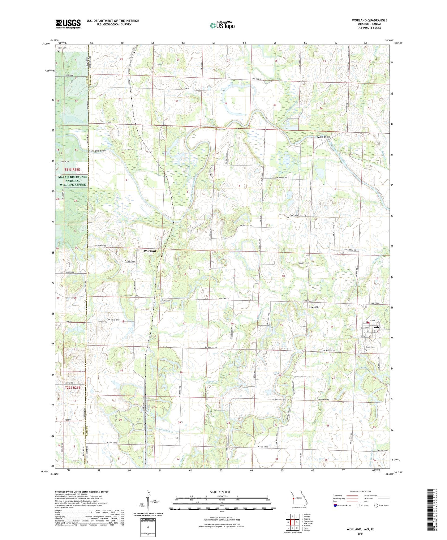
2021 topographic map quadrangle Worland in the states of Missouri, Kansas. Scale: 1:24000. Based on the newly updated USGS 7.5' US Topo map series, this map is in the following counties: Bates, Linn. The map contains contour data, water features, and other items you are used to seeing on USGS maps, but also has updated roads and other features. This is the next generation of topographic maps. Printed on high-quality waterproof paper with UV fade-resistant inks.
Quads adjacent to this one:
West: Pleasanton
Northwest: Boicourt
North: Amoret
Northeast: Virginia
East: New Home
Southeast: Sprague
South: Hume
Southwest: Prescott
This map covers the same area as the classic USGS quad with code o38094b5.
Contains the following named places: Cottonwood Creek, Foster, Foster Post Office, Foster School, Foster Volunteer Fire Department, Gillum Creek, Greenview School, Harmonia, Hays Cemetery, Independence Church, Independence School, Johnson School, Klondike School, Marble Bridge, Mine Creek, Mokan, Mount Zion School, Mulberry Creek, Old Walnut School, Pecan Creek, Rucker, Salem Cemetery, Standish School, State Line Bridge, Tiger, Township of Walnut, Victory School, Village of Foster, Ward, Woodfin Cemetery, Worland, Worland School