MyTopo
Radley Kansas US Topo Map
Couldn't load pickup availability
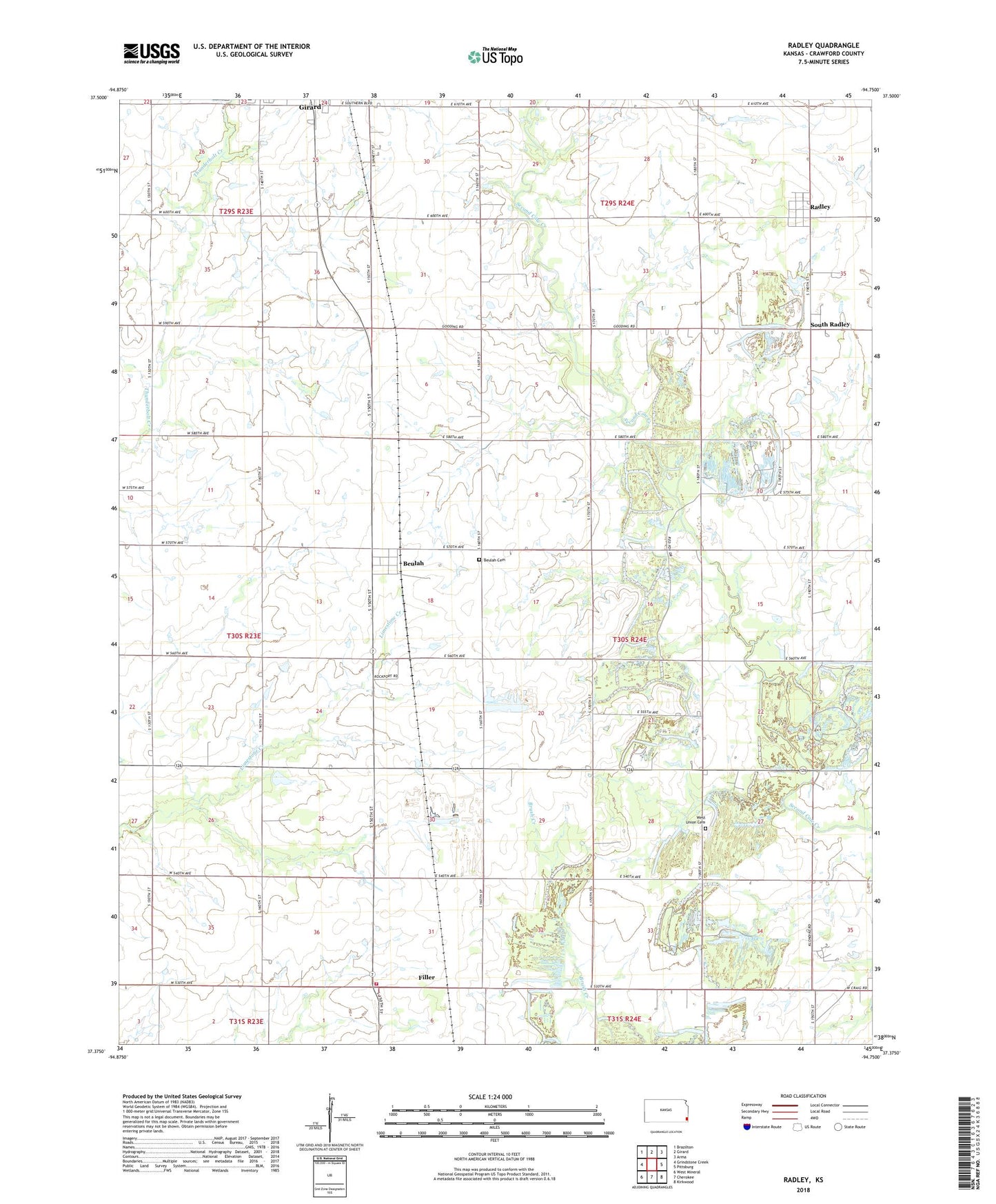
2022 topographic map quadrangle Radley in the state of Kansas. Scale: 1:24000. Based on the newly updated USGS 7.5' US Topo map series, this map is in the following counties: Crawford. The map contains contour data, water features, and other items you are used to seeing on USGS maps, but also has updated roads and other features. This is the next generation of topographic maps. Printed on high-quality waterproof paper with UV fade-resistant inks.
Quads adjacent to this one:
West: Grindstone Creek
Northwest: Brazilton
North: Girard
Northeast: Arma
East: Pittsburg
Southeast: Kirkwood
South: Cherokee
Southwest: West Mineral
This map covers the same area as the classic USGS quad with code o37094d7.
Contains the following named places: Base Line School, Beachner Grain Elevator Number 4, Beulah, Beulah Cemetery, Crawford County Farm, Crawford County Fire District 3, Crossroads Baptist Church, Filler, Gem School, Gooding School, Harmony School, Harport Landing Field, KSEK - FM (Girard), Liberty School, Mount Olive Baptist Church, Mount Zion School, Pleasant Valley School, Radley, Radley Census Designated Place, South Radley, Township of Sheridan, West Union Cemetery, West Union School