MyTopo
Brazilton Kansas US Topo Map
Couldn't load pickup availability
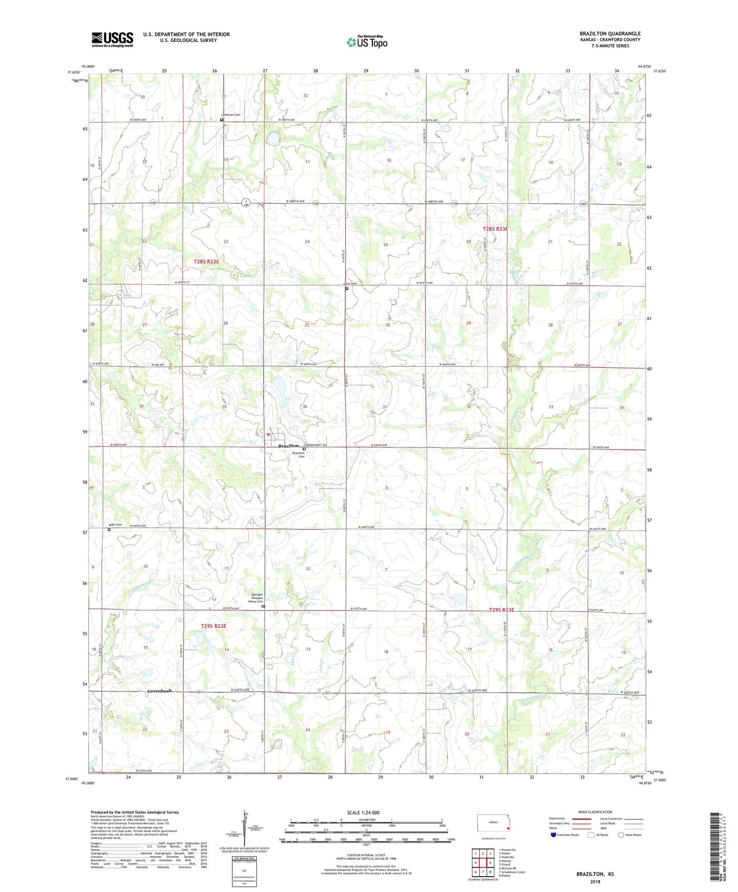
2022 topographic map quadrangle Brazilton in the state of Kansas. Scale: 1:24000. Based on the newly updated USGS 7.5' US Topo map series, this map is in the following counties: Crawford. The map contains contour data, water features, and other items you are used to seeing on USGS maps, but also has updated roads and other features. This is the next generation of topographic maps. Printed on high-quality waterproof paper with UV fade-resistant inks.
Quads adjacent to this one:
West: Walnut
Northwest: Porterville
North: Hepler
Northeast: Hiattville
East: Girard
Southeast: Radley
South: Grindstone Creek
Southwest: McCune NE
This map covers the same area as the classic USGS quad with code o37094e8.
Contains the following named places: Bayless School, Brazilton, Brazilton Cemetery, Brazilton Ruritan Fire Department, Emery School, Fair Oak School, Fairview School, Greenbush, Immanuel Lutheran Church, Iowa Cemetery, Lutheran Cemetery, Lutheran School, Meyers School, Mills Cemetery, Pittsburg State University - Greenbush Astrophysical Observatory, Pleasant Valley School, Saint Aloysius Church, Salem School, Spangler Pleasant Valley Cemetery, ZIP Code: 66743