MyTopo
West Mineral Kansas US Topo Map
Couldn't load pickup availability
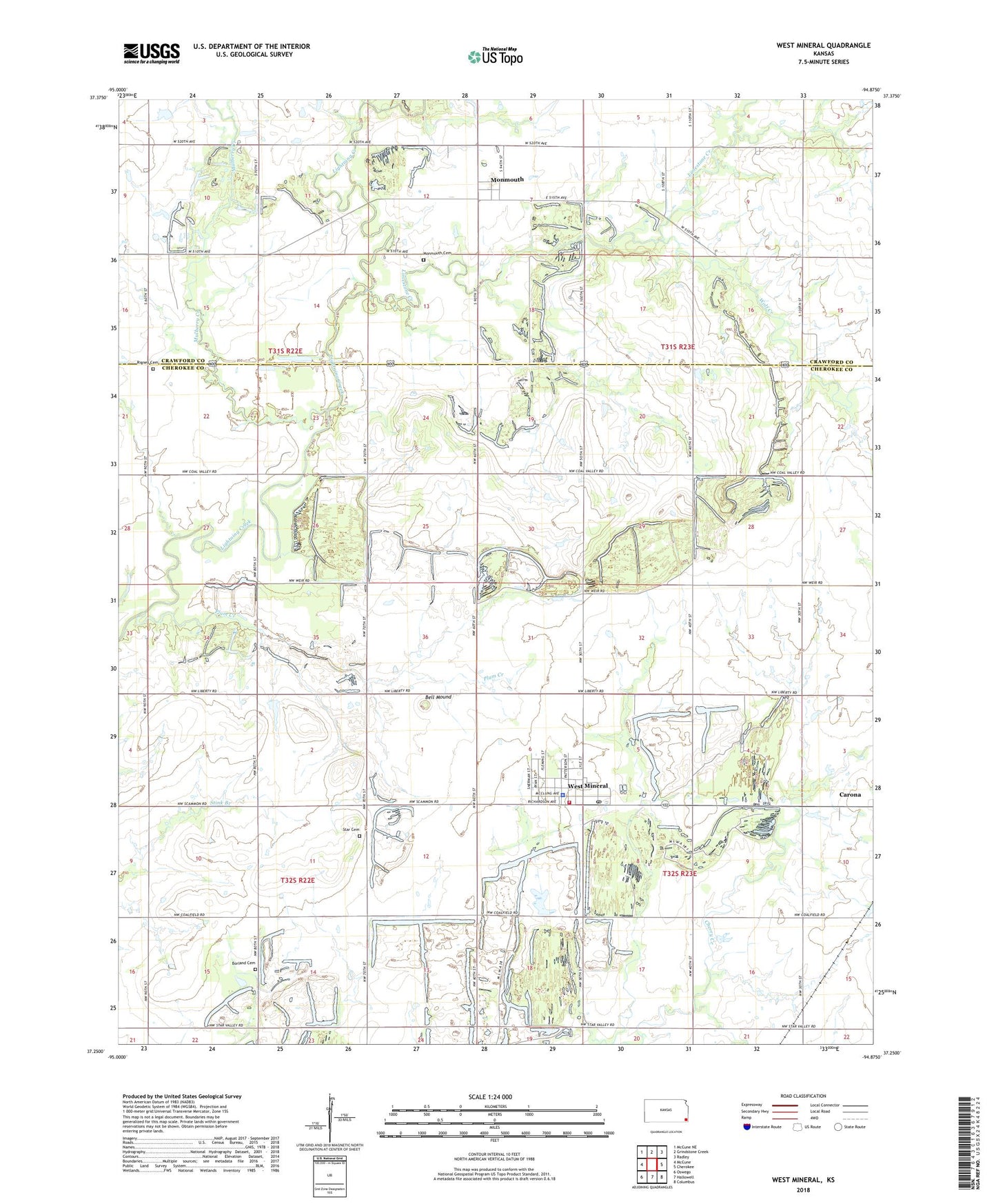
2022 topographic map quadrangle West Mineral in the state of Kansas. Scale: 1:24000. Based on the newly updated USGS 7.5' US Topo map series, this map is in the following counties: Cherokee, Crawford. The map contains contour data, water features, and other items you are used to seeing on USGS maps, but also has updated roads and other features. This is the next generation of topographic maps. Printed on high-quality waterproof paper with UV fade-resistant inks.
Quads adjacent to this one:
West: McCune
Northwest: McCune NE
North: Grindstone Creek
Northeast: Radley
East: Cherokee
Southeast: Columbus
South: Hallowell
Southwest: Oswego
This map covers the same area as the classic USGS quad with code o37094c8.
Contains the following named places: Bell Mound, Borland Cemetery, Bruce, Camp Number Six, Centerville School, Cherry, City of West Mineral, East Mineral, Hamilton Camp, Immaculate Conception Church, Liberty School, Limestone Creek, Mayer, Mined Land Wildlife Area, Mineral Lake, Miriam School, Monmouth, Monmouth Cemetery, Monte Carlo, Mount Olive School, Mulberry Creek, Mulberry School, Pleasant Hill School, Plum Creek, Rigney Cemetery, Star Cemetery, Star School, Starvale, Stone City, Township of Ross, West Mineral, West Mineral Elementary School, West Mineral Fire Department, West Mineral Police Department, West Mineral Post Office, West Mineral Wastewater Treatment Plant, Wolf Creek, ZIP Code: 66782