MyTopo
Lebo Kansas US Topo Map
Couldn't load pickup availability
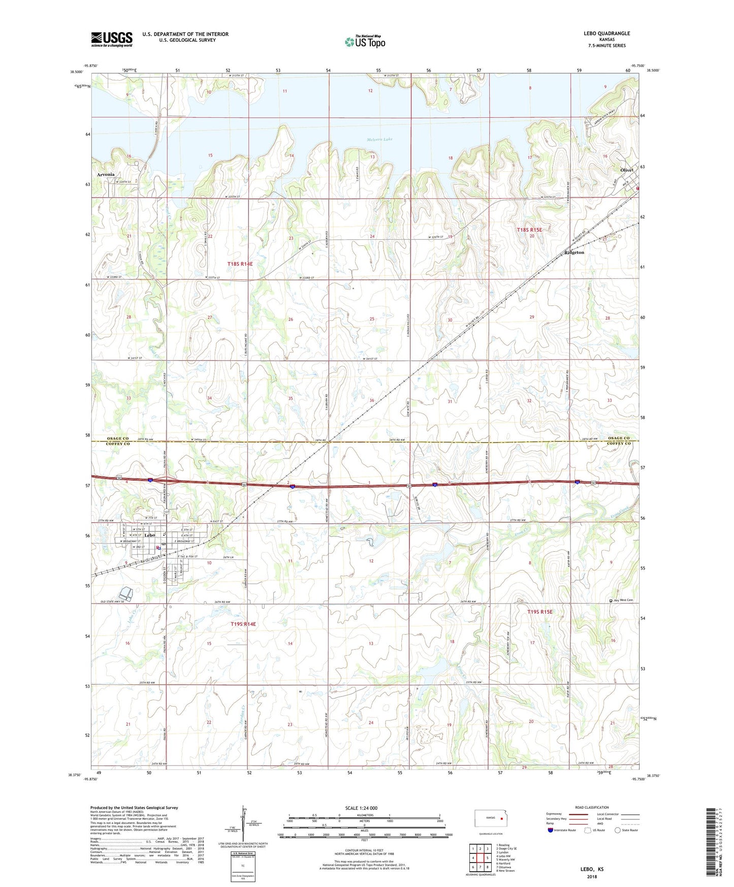
2022 topographic map quadrangle Lebo in the state of Kansas. Scale: 1:24000. Based on the newly updated USGS 7.5' US Topo map series, this map is in the following counties: Osage, Coffey. The map contains contour data, water features, and other items you are used to seeing on USGS maps, but also has updated roads and other features. This is the next generation of topographic maps. Printed on high-quality waterproof paper with UV fade-resistant inks.
Quads adjacent to this one:
West: Lebo NW
Northwest: Reading
North: Osage City SE
Northeast: Lyndon
East: Waverly NW
Southeast: New Strawn
South: Ottumwa
Southwest: Hartford
This map covers the same area as the classic USGS quad with code o38095d7.
Contains the following named places: Arvonia, Cable Creek, City of Lebo, City of Olivet, Coal Creek, Coffey County Fire District 1 Station 6, Coffey County Library Lebo Branch, Key West Cemetery, Lebo, Lebo - Olivet United Methodist Church, Lebo Baptist Church, Lebo Elementary School, Lebo Grain Company Grain Elevator Number 1, Lebo Junior / Senior High School, Lebo Mobile Home Park, Lebo Police Department, Lebo Post Office, Lebo Sewer Treatment Plant, Little Cable Creek, Melvern Lake, Olivet, Osage County Fire District 3 Olivet Station, Ridgeton, Walters Mobile Home Park, ZIP Code: 66856