MyTopo
McCune NE Kansas US Topo Map
Couldn't load pickup availability
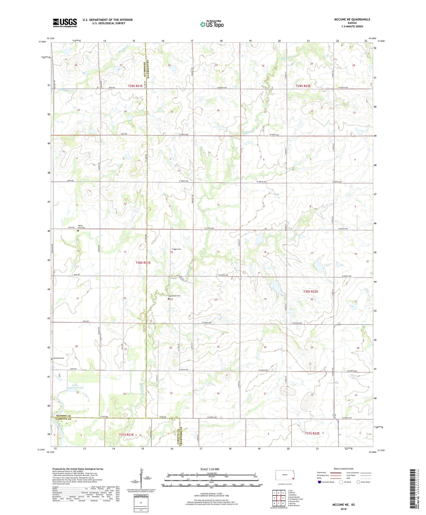
2022 topographic map quadrangle McCune NE in the state of Kansas. Scale: 1:24000. Based on the newly updated USGS 7.5' US Topo map series, this map is in the following counties: Crawford, Neosho, Labette. The map contains contour data, water features, and other items you are used to seeing on USGS maps, but also has updated roads and other features. This is the next generation of topographic maps. Printed on high-quality waterproof paper with UV fade-resistant inks.
Quads adjacent to this one:
West: South Mound
Northwest: Erie
North: Walnut
Northeast: Brazilton
East: Grindstone Creek
Southeast: West Mineral
South: McCune
Southwest: Parsons East
This map covers the same area as the classic USGS quad with code o37095d1.
Contains the following named places: Black Lake, Brush Lake, Dumbauld Cemetery, Frogge Cemetery, Green Elm, Green Elm Church, Halfmoon Lake, Idell, Idell School, Lakeview School, Liberty School, Little Halfmoon Lake, Mound School, Mount Pleasant School, Neutral School, Odell School, Quick School, Richland Cemetery, Township of Osage, Union School, Valley City Cemetery, Valley City School