MyTopo
Williamsburg Kansas US Topo Map
Couldn't load pickup availability
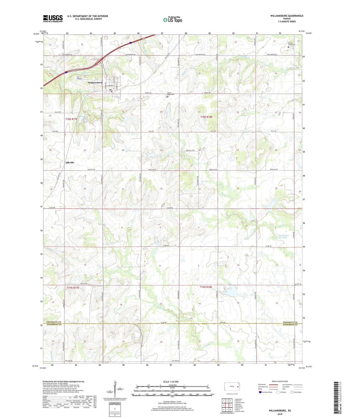
2022 topographic map quadrangle Williamsburg in the state of Kansas. Scale: 1:24000. Based on the newly updated USGS 7.5' US Topo map series, this map is in the following counties: Franklin, Anderson. The map contains contour data, water features, and other items you are used to seeing on USGS maps, but also has updated roads and other features. This is the next generation of topographic maps. Printed on high-quality waterproof paper with UV fade-resistant inks.
Quads adjacent to this one:
West: Waverly
Northwest: Quenemo
North: Pomona
Northeast: Ottawa South
East: Richmond
Southeast: Garnett West
South: Harris
Southwest: Waverly SE
This map covers the same area as the classic USGS quad with code o38095d4.
Contains the following named places: Beachner Grain Elevator Number 27, City of Williamsburg, Emerald, Middle Creek Cemetery, Mill Creek, Mount Hope Cemetery, Saint Patricks School, Shady's Recreational Vehicle Park, Silkville, Township of Williamsburg, Williamsburg, Williamsburg / Homewood Township Fire Department, Williamsburg City Hall, Williamsburg Community Library, Williamsburg Elementary School, Williamsburg Municipal Water Treatment Facility, Williamsburg Post Office, Williamsburg Wastewater Treatment Plant Lagoon 2, ZIP Code: 66095