MyTopo
Waverly Kansas US Topo Map
Couldn't load pickup availability
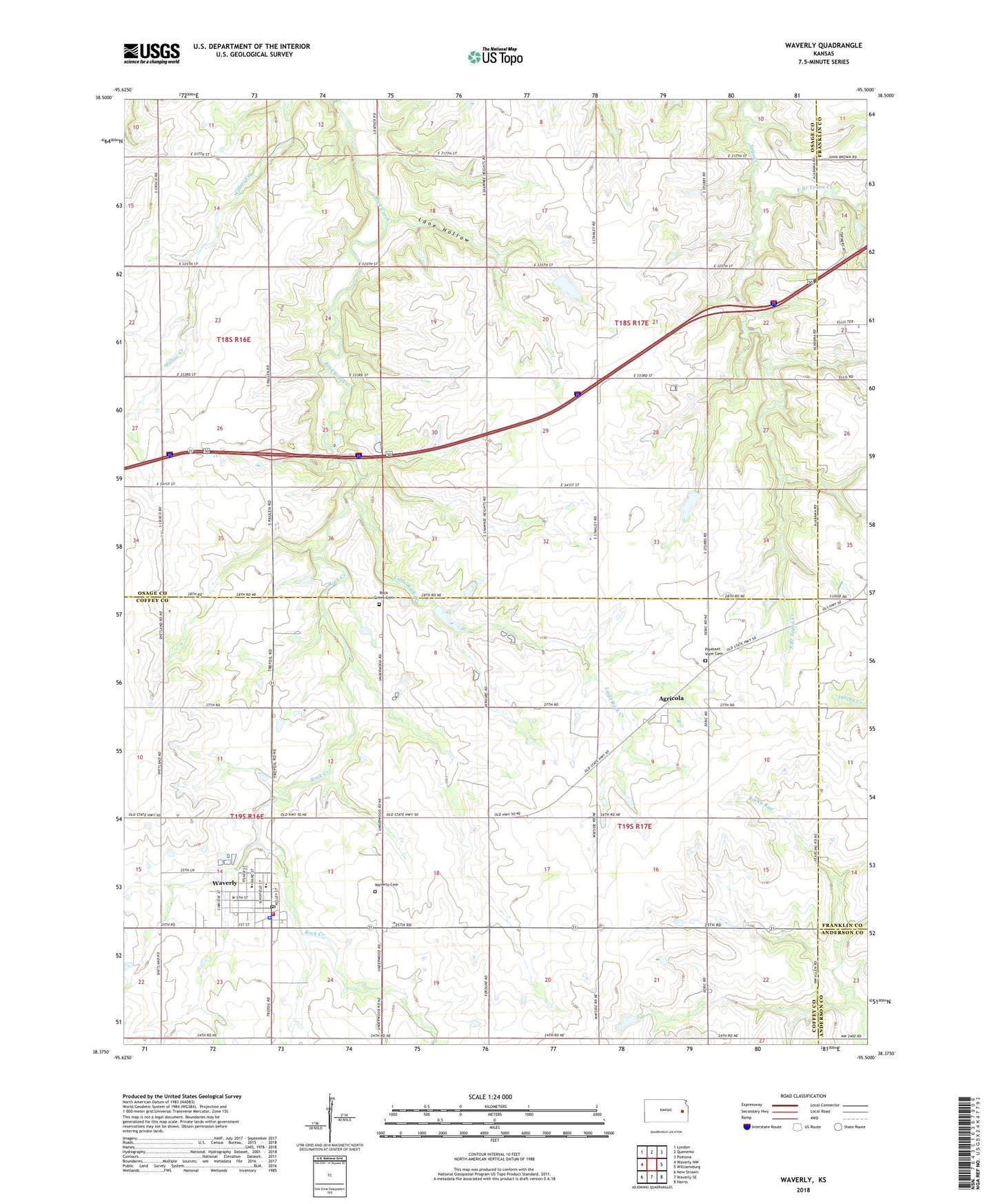
2022 topographic map quadrangle Waverly in the state of Kansas. Scale: 1:24000. Based on the newly updated USGS 7.5' US Topo map series, this map is in the following counties: Osage, Coffey, Franklin, Anderson. The map contains contour data, water features, and other items you are used to seeing on USGS maps, but also has updated roads and other features. This is the next generation of topographic maps. Printed on high-quality waterproof paper with UV fade-resistant inks.
Quads adjacent to this one:
West: Waverly NW
Northwest: Lyndon
North: Quenemo
Northeast: Pomona
East: Williamsburg
Southeast: Harris
South: Waverly SE
Southwest: New Strawn
This map covers the same area as the classic USGS quad with code o38095d5.
Contains the following named places: Agricola, Bethany Church of Christ, Boothe Hall, City of Waverly, Coffey County Fire District 1 Station 7, Coffey County Library Waverly Branch, East Branch Tequa Creek, First Baptist Church, Lane Hollow, Little Rock Creek, Pleasant View Cemetery, Rock Creek Cemetery, Rosemont, Rosemont Church, Saint Joseph Catholic Church, Schoolcraft Airport, South Branch Tequa Creek, Township of Lincoln, Township of Rock Creek, Waverly, Waverly Cemetery, Waverly City Hall, Waverly Community Building, Waverly Elementary School, Waverly Junior / Senior High School, Waverly Police Department, Waverly Post Office, Waverly Sewer Treatment Plant, Waverly United Methodist Church, Weaver, ZIP Code: 66510