MyTopo
Quenemo Kansas US Topo Map
Couldn't load pickup availability
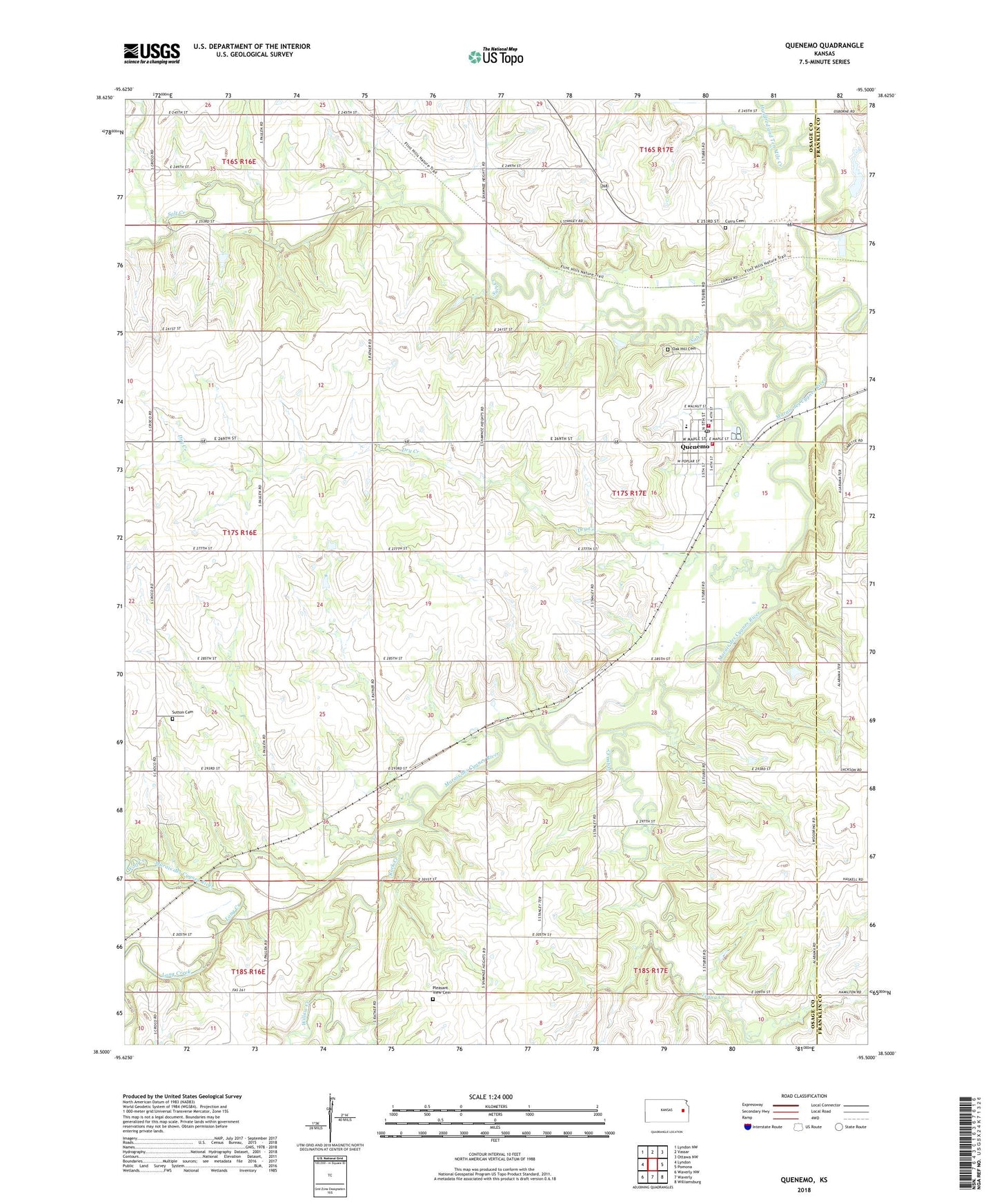
2022 topographic map quadrangle Quenemo in the state of Kansas. Scale: 1:24000. Based on the newly updated USGS 7.5' US Topo map series, this map is in the following counties: Osage, Franklin. The map contains contour data, water features, and other items you are used to seeing on USGS maps, but also has updated roads and other features. This is the next generation of topographic maps. Printed on high-quality waterproof paper with UV fade-resistant inks.
Quads adjacent to this one:
West: Lyndon
Northwest: Lyndon NW
North: Vassar
Northeast: Ottawa NW
East: Pomona
Southeast: Williamsburg
South: Waverly
Southwest: Waverly NW
This map covers the same area as the classic USGS quad with code o38095e5.
Contains the following named places: City of Quenemo, Curry Cemetery - Eastview Cemetery, Dry Creek, Hundred and Ten Mile Creek, Long Creek, Marais des Cygnes Middle School, Marais Des Cygnes Valley Elementary School, Oak Hill Cemetery, Osage County Fire District 7 Quenemo, Pleasant View Cemetery, Quenemo, Quenemo Baptist Church, Quenemo City Fire Department, Quenemo Post Office, Quenemo Sewer Treatment Plant, Rock Creek, Salt Creek, Sutton Cemetery, Tequa Creek, Township of Agency, Willow Creek, Wolf Creek, ZIP Code: 66528