MyTopo
Dwight Kansas US Topo Map
Couldn't load pickup availability
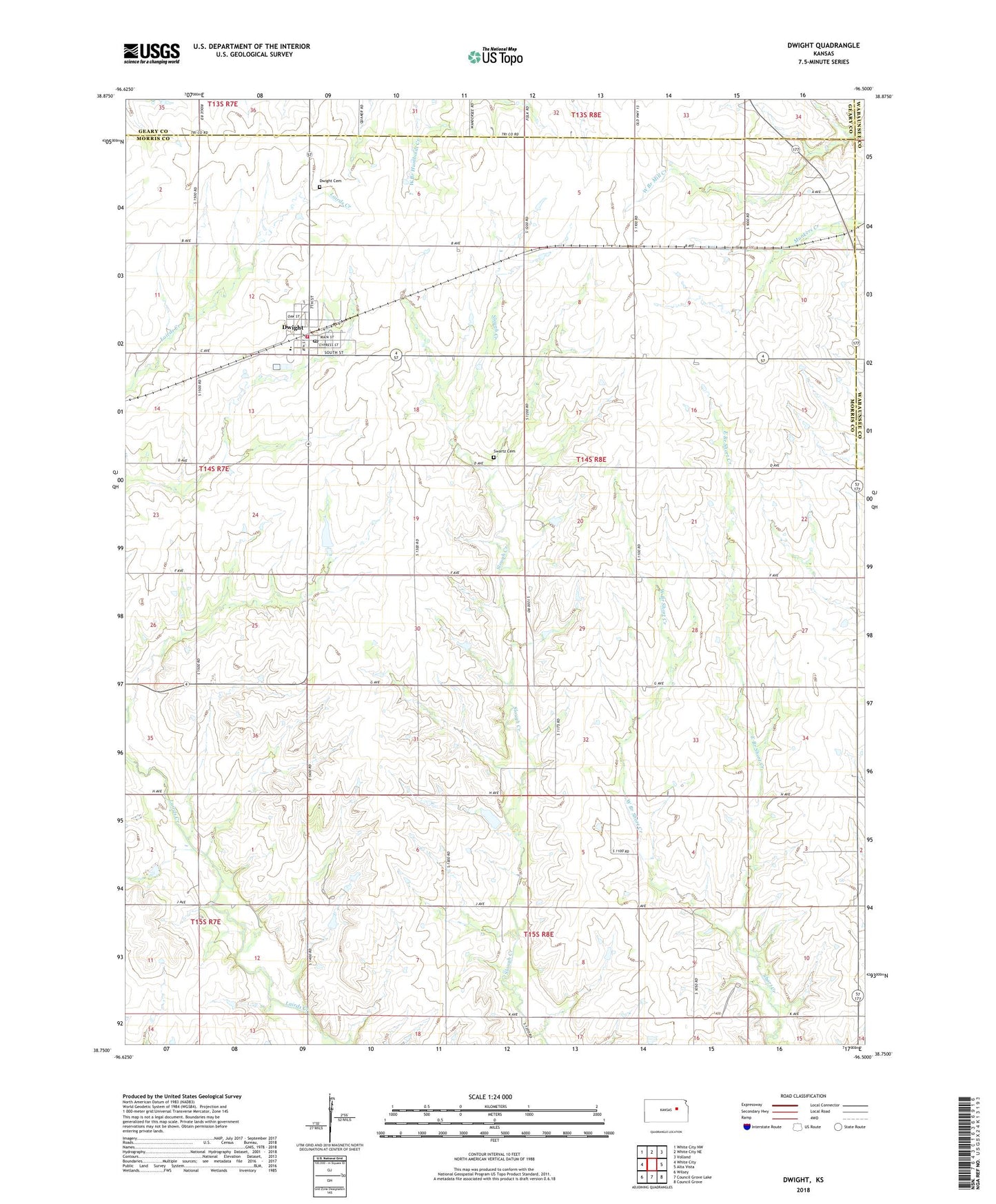
2022 topographic map quadrangle Dwight in the state of Kansas. Scale: 1:24000. Based on the newly updated USGS 7.5' US Topo map series, this map is in the following counties: Morris, Geary, Wabaunsee. The map contains contour data, water features, and other items you are used to seeing on USGS maps, but also has updated roads and other features. This is the next generation of topographic maps. Printed on high-quality waterproof paper with UV fade-resistant inks.
Quads adjacent to this one:
West: White City
Northwest: White City NW
North: White City NE
Northeast: Volland
East: Alta Vista
Southeast: Council Grove
South: Council Grove Lake
Southwest: Wilsey
This map covers the same area as the classic USGS quad with code o38096g5.
Contains the following named places: City of Dwight, Dwight, Dwight Cemetery, Dwight Post Office, Dwight Presbyterian Church, Dwight Public Library, Dwight Rural Fire Department 6, Dwight United Methodist Church, Dwight Wastewater Treatment Plant, East Branch Short Creek, Eisenhut Farm, Miller Dairy Farm, Oleen Farms, Pleasant Ridge Christian Church, Prairie Heights Elementary School, Sunny Slope Farms, Swartz Cemetery, Township 3, West Branch Short Creek